The Yellow River or Huáng Hé is the second longest in China after the Yangtze River, the third longest river in Asia and the sixth-longest in the world at the estimated length of 5,464 kilometers (3,395 miles).
Originating in the Bayankala Mountains in Qinghai province in western China, it flows through 9 provinces of China and empties into the Bohai Sea.
The headwaters of the Yellow River originate at an elevation of 4,500 meters.
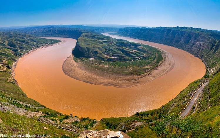
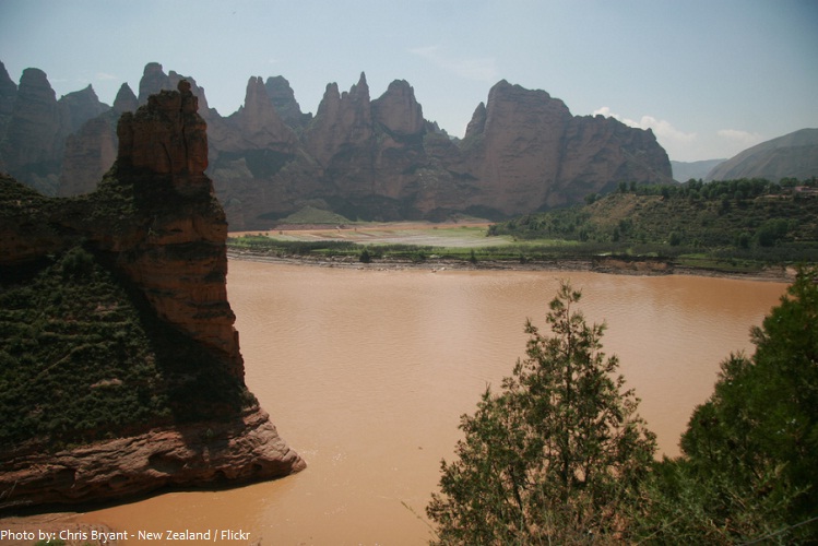
It is called the Yellow River because huge amounts of loess sediment turn the water that color. So much of this mineral-rich soil ends up in the Yellow River that it can fill the riverbed and thus change the river’s course.
It is slow and sluggish along most of its course and some regard it as the world’s muddiest major river, discharging three times the sediment of the Mississippi River.
The average flow rate of the Yellow River is 1,800 cubic meters (63,566 cubic feet) per second.
The Yellow River delta totals 8,000 square kilometers (3,090 square miles).
Its basin area is 752,443 square kilometers (290,520 square miles), containing about 200,000 square kilometers (77,000 square miles) of arable land and over 100 million people.
Its basin was the birthplace of ancient Chinese civilization, and it was the most prosperous region in early Chinese history.
The Yellow River is not just a river of China, but also the symbol of the Chinese spirit: bearing burdens (its sedimentation), adaptation (its course changes), and perseverance (its continual flow).
The river is commonly divided into three stages: upper reaches, middle reaches, and lower reaches.
The upper reaches, about 3,500 kilometers (2,000 miles), includes the upland swamps and pastures of the Tibetan Plateau and gorges in foothill country to the Gobi Desert in Inner Mongolia. Along this length, the elevation of the Yellow River drops 3,496 meters (11,470 ft), with an average grade of 0.10%.
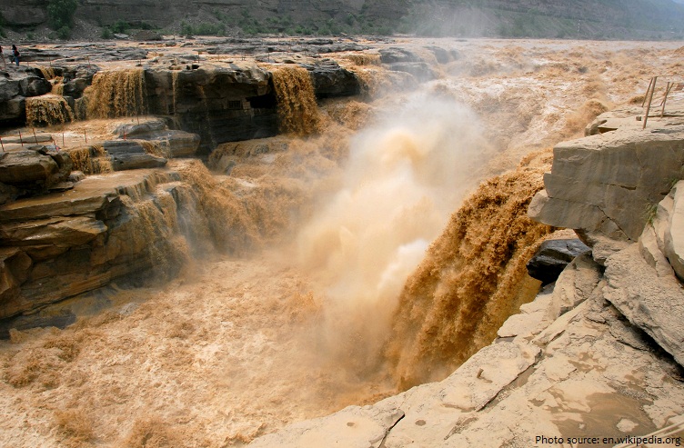
The middle reaches, about 1,200 kilometers (700 miles) from Hekou Town to Zhengzhou, occupies plain and hills in China’s Loess Plateau region, where huge amounts of sediment are suspended. The Hukou Waterfall is in the middle reaches. It is the largest waterfall on the Yellow River and the second largest waterfall in China (after the Huangguoshu Waterfall).
The lower reaches, from Zhengzhou to the Bo Sea, is about 800 kilometers (500 miles). Due to sediment accumulation, the riverbed is several meters above the cities and farmlands, forming the world-famous “above ground river”.
Tributaries of the Yellow River include: White River, Black River, Star River, Daxia River, Tao River, Zuli River, Qingshui River, Dahei River, Kuye River, Wuding River, Fen River, Wei River, Luo River, Qin River, Dawen River, Kuo River. The Wei River is the largest of these tributaries.
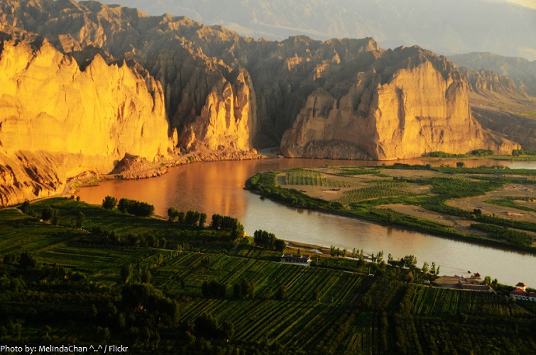
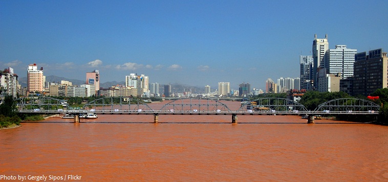
The following are the major tourist cities on the Yellow River from source to sea: Lanzhou [pic. below], Zhongwei, Yinchuan, Baotou, Yan’an, Luoyang, Zhengzhou, and Kaifeng.
The Yellow River’s top attractions include forest parks, deserts, grasslands, Hukou Waterfall, the Loess Plateau, and ancient cities.
Since 1960 over 14 dams have been constructed on the river for hydroelectric power, which is vital to northern China’s infrastructure.
The Yellow River is one of several rivers that are essential for China’s very existence. At the same time, however, it has been responsible for several deadly floods, including the only natural disasters in recorded history to have killed more than a million people. The deadliest was a 1332–33 flood that killed 7 million people. Close behind is the 1887 flood, which killed anywhere from 900,000 to 2 million people, and a 1931 flood (part of a massive number of floods that year) that killed 1–4 million people
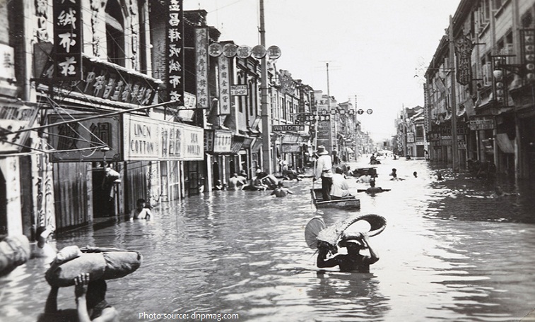
Between 608 BC and 1938 AD, the Yellow River changed course 26 times, and flooded over 1,500 times.
Because of frequent devastating floods and course changes produced by the continual elevation of the river bed, sometimes above the level of its surrounding farm fields, it also has the names China’s Sorrow and Scourge of the Sons of Han.
Since 1972, the Yellow River often runs dry before it reaches the sea. The low volume is due to increased agricultural irrigation, increased by a factor of five since 1950.
Neolithic (7,000 BC-3,700 BC), Bronze (3,700 BC-2,700 BC) and Iron Age Sites (770 BC), and so on can be found in the Yellow River’s drainage basin, which had been the center of ancient Chinese culture since the Azilian (Middle Stone Age).
In ancient times, it was believed that the Yellow River flowed from Heaven as a continuation of the Milky Way.