
Turkmenistan is a country in Central Asia.
The official name of the country is Turkmenistan and was formerly known as Turkmenia.
It is bordered by Kazakhstan to the northwest, Uzbekistan to the north and east, Afghanistan to the southeast, Iran to the south and southwest, and the Caspian Sea to the west.
The official language is Turkmen.
As of 1 January 2017, the population of Turkmenistan was estimated to be 5,477,176 people.
It is the 52nd largest country in the world by area with 488,100 square kilometers (188,500 square miles).
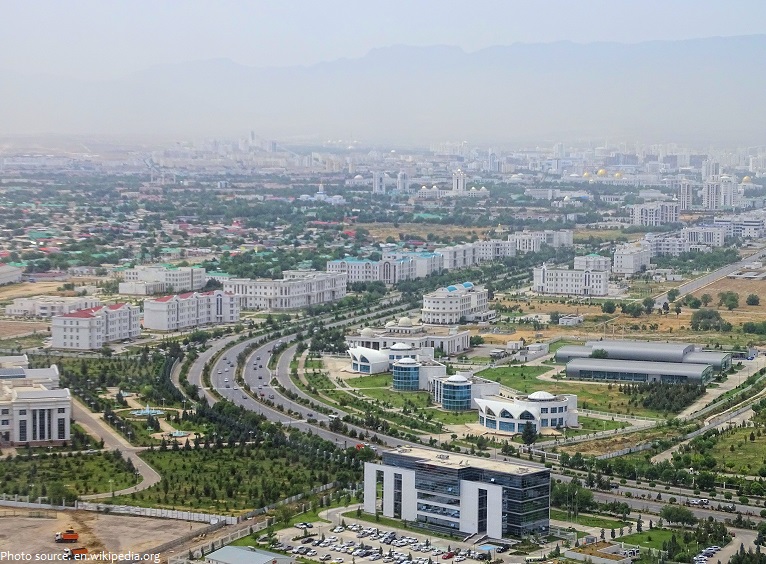
Ashgabat is the capital and the largest city of Turkmenistan. It is situated between the Karakum Desert and the Kopet Dag mountain range. The name means “city of love” or “city of devotion.”
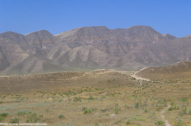
The terrain of Turkmenistan is mostly flat-to-rolling sand dunes and desert with mountains to the south.
Turkmenistan’s average elevation is 100 to 220 meters (328 to 722 feet) above sea level.
Aýrybaba is the highest mountain in Turkmenistan at 3,138 meters (10,295 feet) above sea level.
Its coastline with the Caspian Sea is 1,768 kilometers (1,098 miles).
Protected areas of Turkmenistan include 8 nature reserves and 13 sanctuaries with a total area of 19,750 square kilometers (7,625 square miles) or more than 4% of Turkmenistan’s territory.
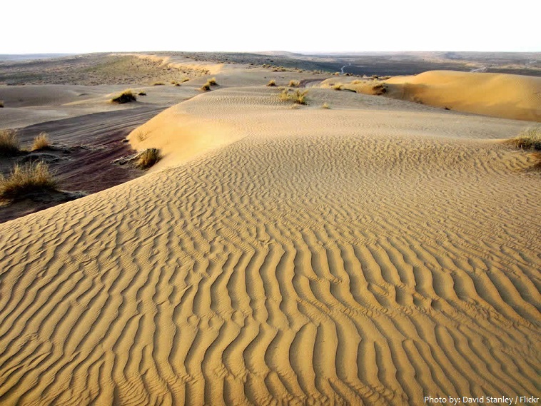
The Karakum Desert occupies about 70%, or 350,000 square kilometers (135,135 square miles) of the area of Turkmenistan. Its name is translated as “black sands” (“kara” – black, “kum” – sand).
Turkmenistan has 3 UNESCO world heritage sites.
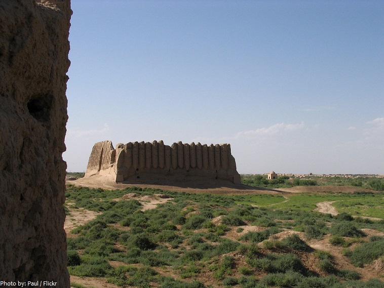
Merv is the oldest and best-preserved of the oasis-cities along the Silk Route in Central Asia. The remains in this vast oasis span 4,000 years of human history. A number of monuments are still visible, particularly from the last two millennia. It is claimed that Merv was briefly the largest city in the world in the 12th century. The site of ancient Merv has been listed by UNESCO as a World Heritage Site.
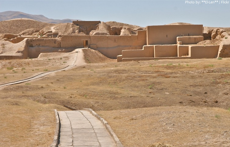
The Parthian Fortresses of Nisa consist of two tells of Old and New Nisa, indicating the site of one of the earliest and most important cities of the Parthian Empire, a major power from the mid 3rd century BC to the 3rd century AD. They conserve the unexcavated remains of an ancient civilization which skilfully combined its own traditional cultural elements with those of the Hellenistic and Roman west. The Parthian Fortresses at Nisa was declared a World Heritage Site by UNESCO in 2007.
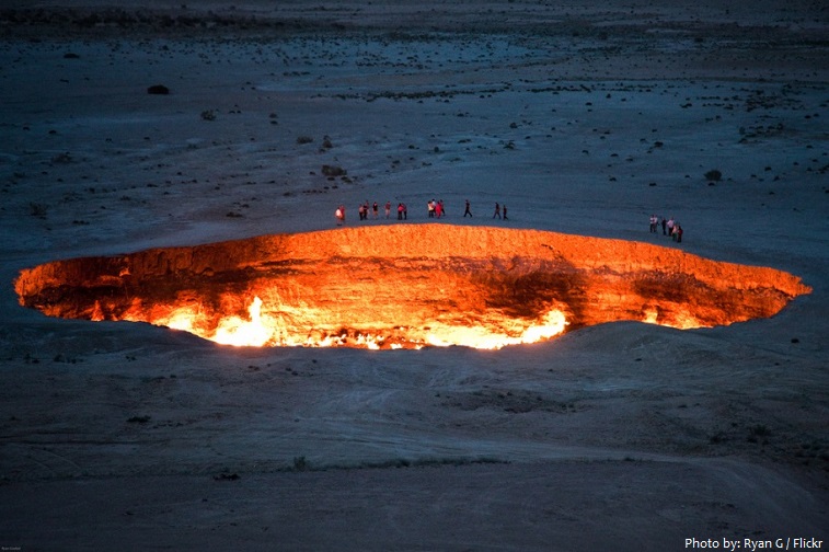
The Darvaza gas crater, known locally as the “Door to Hell” or ”Gates of Hell”, is a natural gas field in Derweze, Turkmenistan, that collapsed into an underground cavern in 1971, becoming a natural gas crater. Geologists set it on fire to prevent the spread of methane gas, and it has been burning continuously since then. The diameter of the crater is 69 meters (226 feet), and its depth is 30 meters (98 feet).
Turkmenistan has been at the crossroads of civilizations for centuries.
In medieval times, Merv was one of the great cities of the Islamic world and an important stop on the Silk Road, a caravan route used for trade with China until the mid-15th century.
Annexed by the Russian Empire in 1881, Turkmenistan later figured prominently in the anti-Bolshevik movement in Central Asia.
In 1924, Turkmenistan became a constituent republic of the Soviet Union, Turkmen Soviet Socialist Republic (Turkmen SSR)
Turkmenistan became independent upon the dissolution of the Soviet Union in 1991.
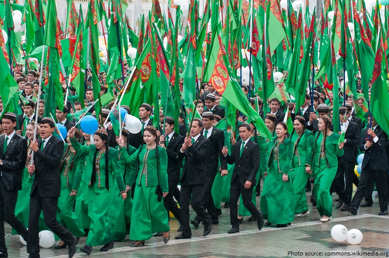
Independence Day of Turkmenistan is the main state holiday in Turkmenistan. This date is celebrated in Turkmenistan annually on October 27.
Turkmenistan was ruled by President for Life Saparmurat Niyazov until his death in 2006. Gurbanguly Berdimuhamedow was elected president in 2007.
Turkmenistan possesses the world’s fourth largest reserves of natural gas resources and substantial oil resources.
Since 1993, citizens have received government-provided electricity, water and natural gas free of charge.
In Turkmenistan, most of irrigated land is planted with cotton, making the country the world’s ninth-largest cotton producer.
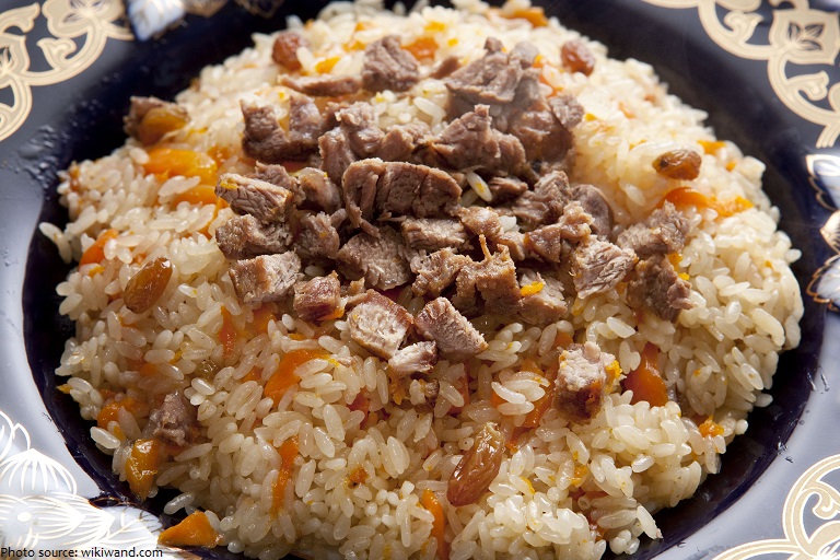
Turkmen cuisine is similar to that of the rest of Central Asia. Plov (pilaf) is the staple, everyday food, which is also served at celebrations. It consists of chunks of mutton, carrots and rice fried in a large cast-iron cauldron similar to a Dutch oven.
As in the rest of Central Asia, green tea is the primary drink, consumed at all hours.
Akhal-Teke horses are a national emblem of Turkmenistan, where the breed originated.
After Kazakhstan, Turkmenistan is the least densely populated of the Central Asian states.
The name Turkmenistan was derived from the Persian language, and it simply means “Land of the Turkmen.”
There are 789,151 people in Turkmenistan using Internet (14.9% of the population) as of June, 2016.
Turkmenistan is world widely famous for its ethnic style of carpets and there is even a carpet museum with Turkmen carpets from the medieval through to the 20th century, including over 1000 carpets from the 18th and 19th centuries.
Saparmurat Niyazov (the leader of Turkmenistan from 1985 until his death in 2006) renamed months and days of the week after Turkmen heroes, poets, historical events, family members and himself. For example, instead of April there was Gurbansoltan, his mother’s name.