The Harbor of Rio de Janeiro is located in Brazil and was created by erosion from the Atlantic Ocean and is also known as Guanabara Bay.
Guanabara Bay was formed naturally by the Atlantic Ocean. Over time, the sea eroded the rocks and sand developing the bay we recognize today.
The erosion occurred in such a way that if you look at the bay from different angles, it can look like a river mouth, or even a lake.
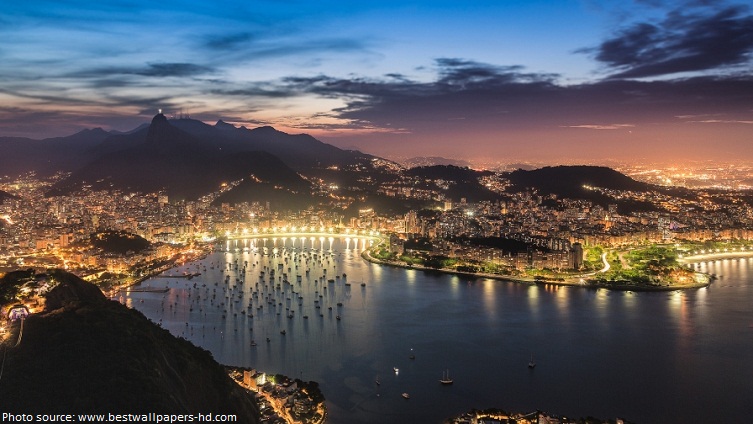
Guanabara Bay, or the Harbor of Rio de Janeiro, is the world’s largest natural deep-water bay in the world, based on the volume of water in it.
It is the second largest bay in area in Brazil (after the All Saints’ Bay), at 412 square kilometers (159 square miles), with a perimeter of 143 kilometers (89 miles).
The Harbor of Rio de Janeiro is 31 kilometers (19.2 miles) long and 28 kilometers (17.3 miles) wide at its maximum.
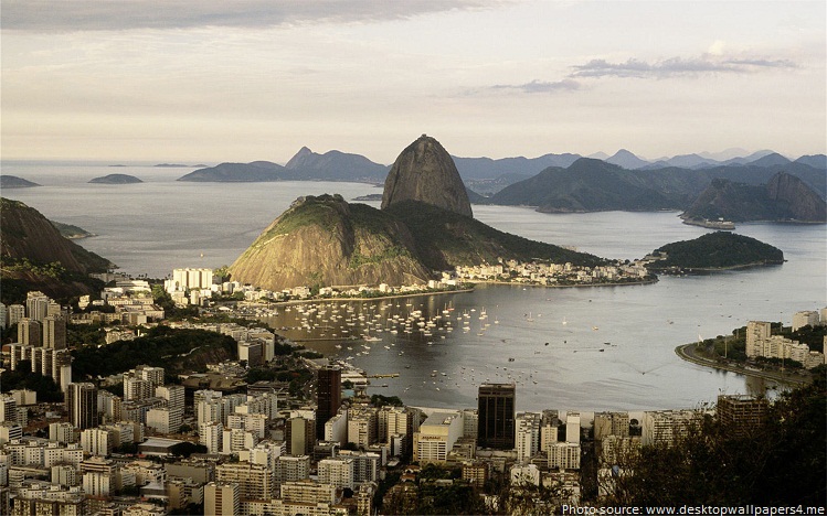
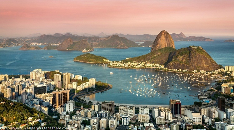
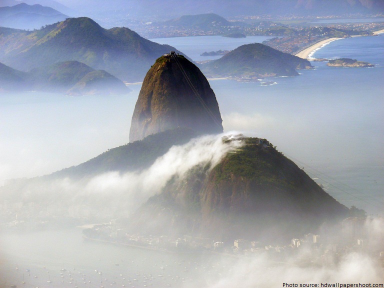
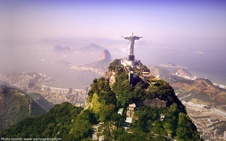
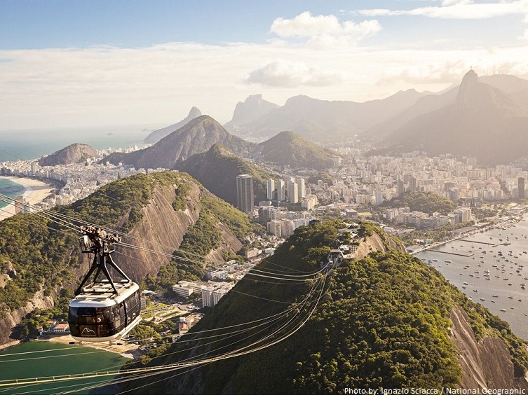
The Harbour is surrounded by gorgeous granite monolith mountains that include the famous Sugar Loaf Mountain at 395 meters (1,296 feet), Corcovado Peak at 704 meters (2,310 feet), and the hills of Tijuca at 1021 meters (3,350 feet).
These mountains are a part of a mountain chain (Serra do Mar) that runs 1500 kilometers (932 miles) along the coast of South America.
There are more than 130 islands within the Harbor of Rio de Janeiro including Governor’s island, Fundao and Snakes Island.
The incredible bay has some of the most spectacular beaches with white sand and crystal waters – there are around 80 kilometers (50 miles) of beaches in total!
One aspect which makes the Harbor of Rio de Janeiro more famous is the humongous statue of Christ the Redeemer which stands tall, overlooking the city from its location high up on Corcovado Mountain.
It was discovered by Portuguese explorers led by Goncalo Coelho, on January 1, 1502. He called it Rio de Janeiro which is Portuguese for “River of January“.
The harbor was discovered as they were trying to map the shoreline of the South American continent.
The area was later colonized by the French and Portuguese.
In 1555 five hundred French colonists built a Fort on one of the Bay’s islands they named for their leader, French Admiral Nicolas Durand de Villegaignon. Five years later the citadel, Fort Coligny, fell to a siege by Portugal’s navy and the French fled. Today the location, now called The Isle of Villegaignon, is home to the Brazilian Naval School.
The Harbor of Rio de Janeiro is one of the Seven Natural Wonders of the World.
It had been known as one of the most beautiful natural harbours.
The best ways to see the Harbor of Rio de Janeiro are to get above it.This can be done either through helicopter or for the more adventurous through the use of a hang glider. The most common means of seeing this wonder are to travel to the tops of the surrounding granite peaks that overlook the harbor.
Great view of the bay and its surrounds is from the top of Sugar Loaf Mountain. A cable car will take you to the top, with some great views on the way.
The Tamoio people who were the original inhabitants of the the area named the bay “Guanabara“. The name means “arm of the sea“.
Charles Darwin visited the place in 1832 and while describing the place he wrote that it seemed almost unreal.
The bay is spanned by a bridge from just north of Rio de Janeiro’s center to Niterói.
The climate at the Harbor of Rio de Janeiro is generally good all year round.Summer temperature between December and March is between 35 to 39ºC (95 to 100ºF). Winter temperatures are between 20 to 30ºC (68 to 86ºF).
September and October are the best months to visit the Harbor of Rio de Janeiro. The weather is nice and the humidity has not set in.