The Rio Grande is one of the principal rivers in the southwest United States and northern Mexico.
Its name is Spanish for the “Big River,” but the Rio Grande is actually known as Rio Bravo in Mexico. “Bravo” translates as “ furious,” so the name makes sense.
The length of the Rio Grande is approximately 3,051 kilometers (1,885 miles), though course shifts occasionally result in length changes.
The Rio Grande is the fourth longest river in North America.
The Rio Grande flows through seven states, three U.S states, and four Mexican states. It flows through Colorado, New Mexico, Texas, Chihuahua, Coahuila, Nuevo León and Tamaulipas.
The river rising as a clear, snow-fed mountain stream more than 3,700 meters (12,000 feet) above sea level in the Rocky Mountains.
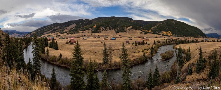
Its early course follows a canyon through forests of spruce, fir, and aspen into the broad San Luis Valley in Colorado, after which it cuts the Rio Grande Gorge and White Rock Canyon of northern New Mexico and enters the open terrain of the Basin and Range and Mexican Plateau physiographic provinces.
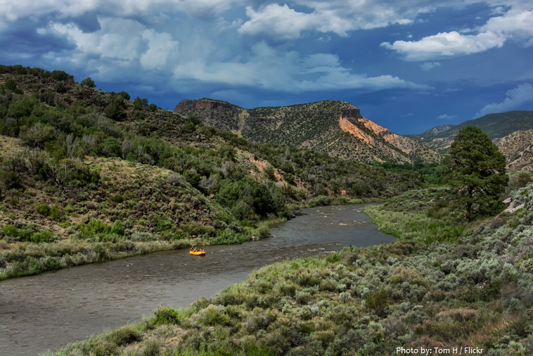
There, declining elevation, decreasing latitude, and increasing aridity and temperature produce a transition from a cold steppe climate with a vegetation of piñon pine, juniper, and sagebrush to a hot steppe and desert climate characterized by mesquite, creosote bush, cactus, yucca, and other desert plants.
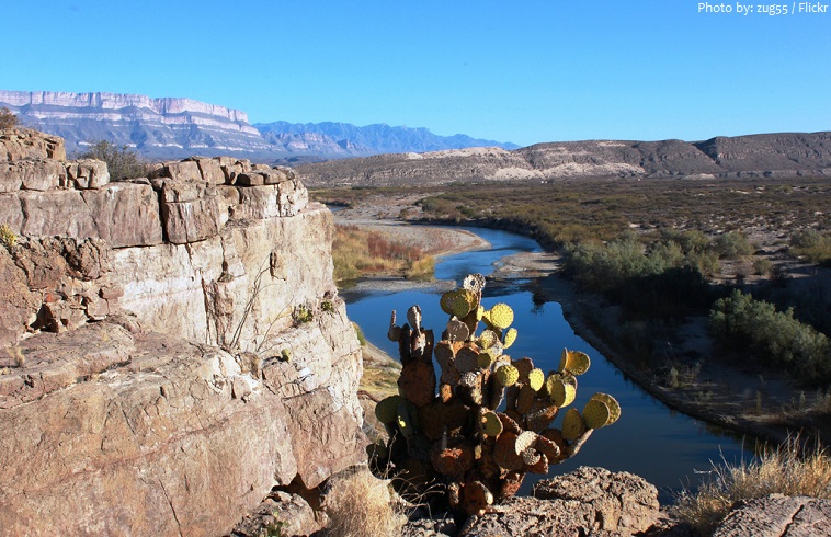
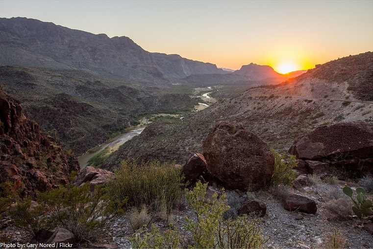
Shortly before entering the Gulf Coastal Plain, the Rio Grande cuts three canyons between 460 and 520 meters (1,500 and 1,700 feet) in depth across the faulted area occupied by the “big bend,” where the Texas side of the river comprises the Big Bend National Park.
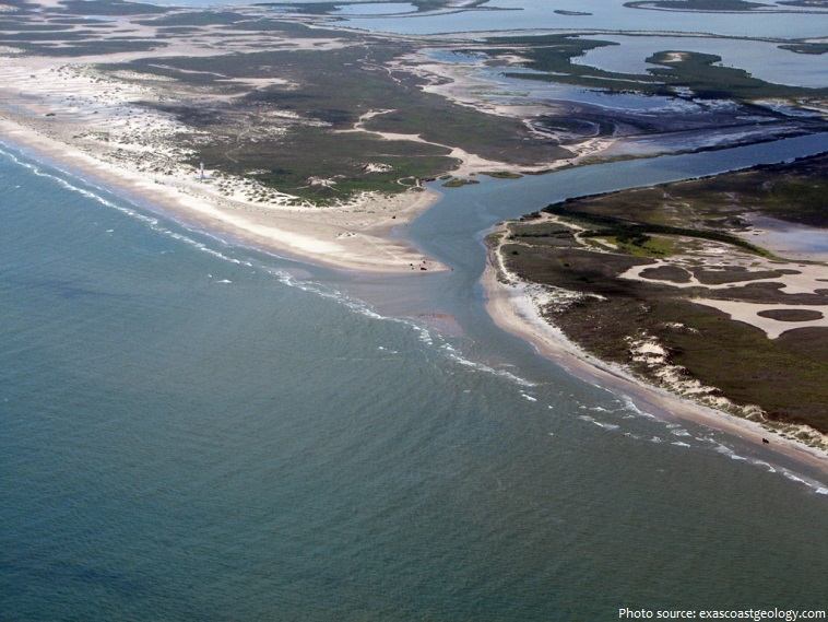
Along the remainder of its course the river wanders sluggishly across the Gulf Coastal Plain to end in a fertile delta where it joins the Gulf of Mexico.
The drainage basin or watershed of the Rio Grande encompasses 472,000 square kilometers (182,200 square miles). Approximately half of the entire watershed is in Mexico, and half lies within the United States.
In some places the depth of the river has varied from about 18 meters (60 feet) to a bare trickle or nothing.
The average discharge is 68 cubic meters (2,403 cubic feet) per second.
The principal tributaries of the Rio Grande are the Pecos, Devils, Chama, and Puerco rivers in the United States and the Conchos, Salado, and San Juan in Mexico.
A number of dams are on the Rio Grande, including Rio Grande Dam, Cochiti Dam, Elephant Butte Dam, Caballo Dam, Amistad Dam, Falcon Dam, Anzalduas Dam, and Retamal Dam.
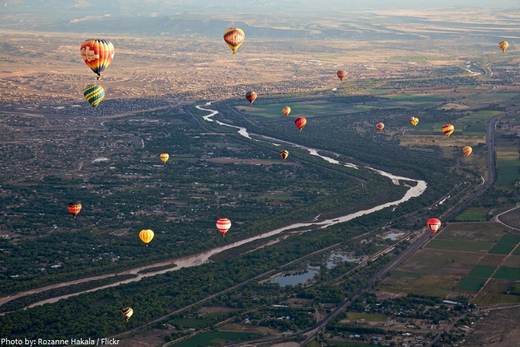
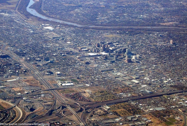
Major cities and towns alongside the river are Santa Fe, Albuquerque [photo below] , Socorro, Truth or Consequences, Mesilla, and Las Cruces in New Mexico; and El Paso, Presidio, Del Rio, Eagle Pass, Laredo, Rio Grande City, McAllen, and Brownsville in Texas.
In Mexico the primary towns and cities are Ciudad Juarez, Ojinaga, Ciudad Acuna, Piedras Negras, Nuevo Laredo, Camargo, Reynosa, and Matamoros.
This river has quite a history, and even today, it has a big impact on the people living near it.
A European expedition to the Gulf of Mexico coast occurred in 1519, and while it is believed they must have seen the Rio Grande, the maps created on that trip showed only nameless indentations to mark the mouths of rivers.
The name Río Bravo shows up for the first time on a map of 1536 compiled by a royal Spanish cartographer.
In-depth exploration of the Rio Grande basin did not occur until just prior to mining and agricultural settlements of the late sixteen1th to the eighteen1th centuries.
During the late-1830s and early-1840s, the river marked the disputed border between Mexico and the nascent Republic of Texas; Mexico marked the border at the Nueces River.
The disagreement provided part of the rationale for the US invasion of Mexico in 1846, after Texas had been admitted as a new state. Since 1848, the Rio Grande has marked the boundary between Mexico and the United States.
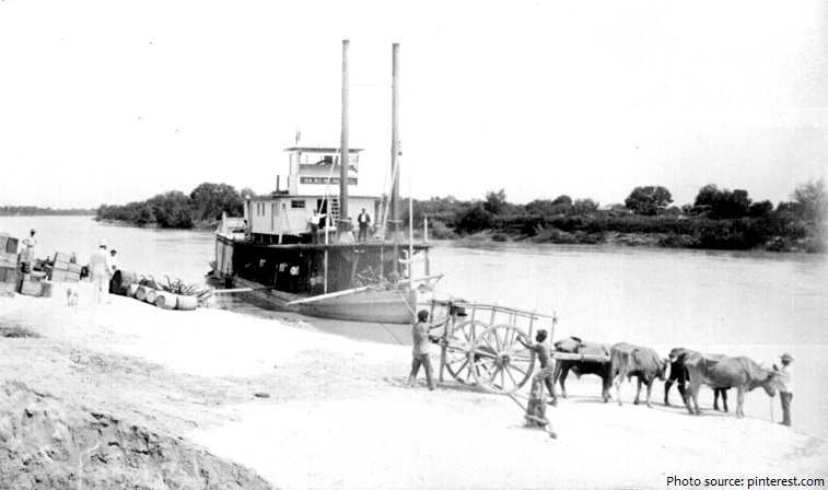
Navigation was active during much of the 19th century,with over 200 different steamboats operating between the river’s mouth close to Brownsville, and Rio Grande City, Texas.
In 1944, the US and Mexico signed a treaty regarding the river, and in 1997, the US designated the Rio Grande as one of the American Heritage Rivers.
The Rio Grande today is mostly used for agriculture and domestic water supply. Sadly, much of the water has been drained from the river. Parts of the river are almost dry! This is because people use more water from the river than the river can get back from rain and other sources.
Principal crops vary along the river. Colorado and northern New Mexico grow potatoes and alfalfa. Southern New Mexico and West Texas specialize in cotton, peppers, onions, and pecans. The lower Rio Grande valley raises citrus fruits, vegetables, and cotton. Agriculture and cattle raising are the leading industries along the entire Rio Grande, although maquiladoras are rapidly becoming the leading employer, especially in Mexico.
The Rio Grande basin is a globally important region for freshwater biodiversity. The Rio Grande supports 121 fish species, 69 of which are found nowhere else on the planet. There are 3 areas supporting endemic bird species as well as a very high level of mollusk diversity.