The Great Salt Lake is located in the northern part of the U.S. state of Utah.
It is the largest salt water lake in the Western Hemisphere, the eighth-largest terminal lake in the world, and the 33rd largest lake on Earth.
It is also the largest lake in the United States that is not part of the Great Lakes region.
The Great Salt Lake has a surface area of 4,400 square kilometers (1,700 square miles) on an average year.
Due to its shallowness, the water level can fall dramatically in dry years and rise during high precipitation years.
In 1963 it reached its lowest recorded size at 2,460 square kilometers (950 square miles), but in 1988 the surface area was at the historic high of 8,500 square kilometers (3,300 square miles)
Its surface is about 1,280 meters (4,200 feet) above sea level, when lake is at average level.
The Great Salt Lake has a maximum length of 120 kilometers (75 miles) and maximum width of 45 kilometers (28 miles), when lake is at average level.
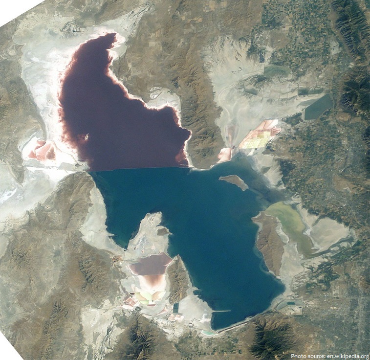
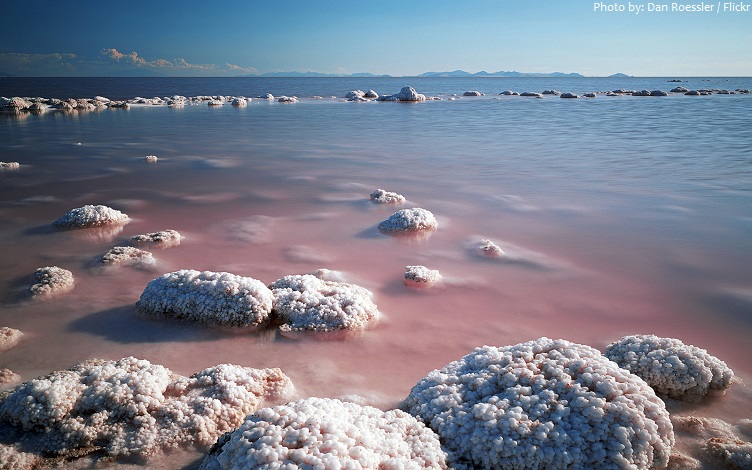
The difference in colors between the northern and southern portions of the lake is the result of a railroad causeway which divide the lake. The rosy color of the northern waters is the result of the pigmented, salt-loving microbes.
The lake’s average depth is 4,9 meters (16 feet), while its greatest depth is 10 meters (33 feet) when lake is at average level.
Volume of water within the lake is 18.9 cubic kilometers (4.5 cubic miles) or 18.9 trillion liters (5 trillion gallons) when lake is at average level.
The drainage basin of the lake covers an area of about 55,685 square kilometers (21,500 square miles).
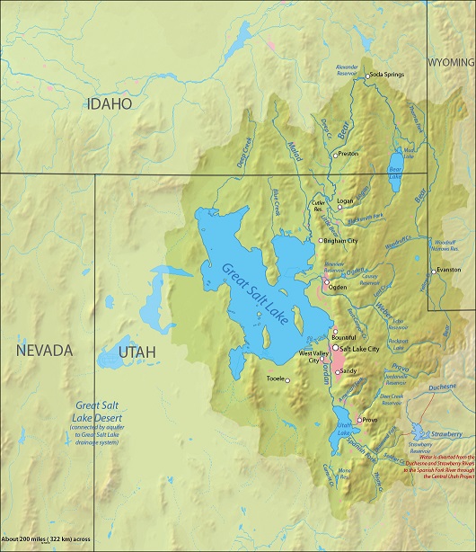
The lake receives water from numerous perennial and intermittent streams originating in the surrounding mountains, the most important of which are the Bear, Weber, and Jordan rivers.
The Jordan, Weber, and Bear rivers deposit around 1.1 million tons of minerals in the lake each year, and the balance of evaporated water is mineral-free, concentrating the lake further.
The Great Salt Lake is a terminal lake because it has no surface outlet (rivers flowing from it).
The Great Salt Lake is a lake with a very high saline level and is considered to be the “Dead Sea of America”.
The salinity of the Great Salt Lake ranges from 5 to 27%. For comparison, the average salinity of the world ocean is 3.5% (35 parts per thousand) and 33.7% in the Dead Sea.
The high salinity in parts of the lake makes them uninhabitable for all but a few species, including brine shrimp, brine flies, and several forms of algae.
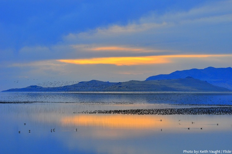
The Great Salt Lake provide critical habitat for millions of migratory shorebirds and waterfowl in western North America.
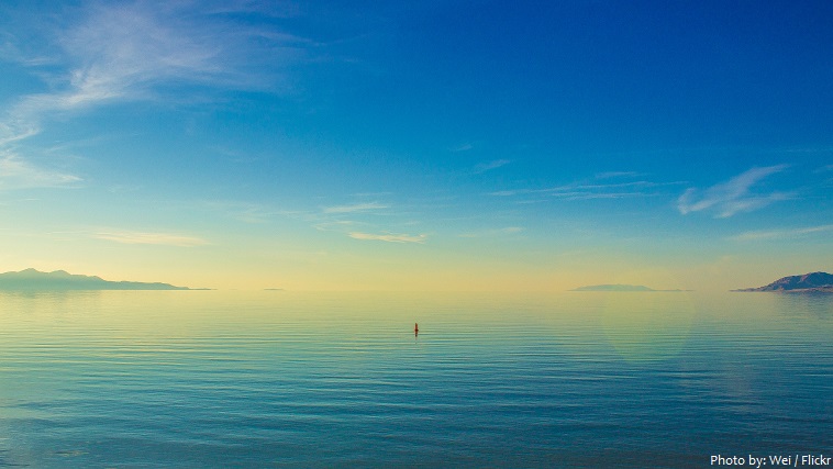
Because of its unusually high salt concentration, most people can easily float in the lake as a result of the higher density of the water, particularly in the saltier north arm of the lake, Gunnison Bay.
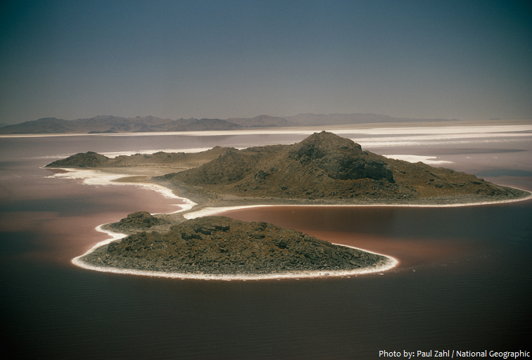
Categorically stating the number of islands is difficult, as the method used to determine what is an island is not necessarily the same in each source.
The Utah Geological Survey, states “the lake contains 11 recognized islands, although this number varies depending on the level of the lake. Seven islands are in the southern portion of the lake and four in the northwestern portion.”
Antelope Island, with an area of 109 square kilometers (42 square miles), is the largest island. Antelope Island has natural scenic beauty and holds one of the largest free roaming herds of American bison in the U.S.. There are also populations of pronghorn, bighorn sheep, porcupine, badger, coyote, bobcat, and millions of waterfowl.
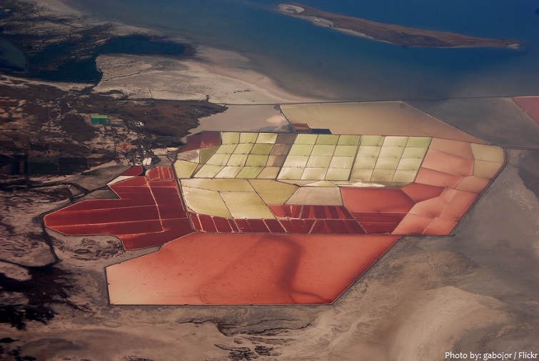
Solar evaporation ponds at the edges of the lake produce salts and brine (water with high saltquantity).
Due to the warm waters of the Great Salt Lake, lake-effect snows are frequent phenomena of the surrounding area. Lake-effect snow is produced during cooler atmospheric conditions when a cold air mass moves across long expanses of warmer lake water, warming the lower layer of air which picks up water vapor from the lake, rises up through the colder air above, freezes and is deposited on the leeward (downwind) shores.
Dramatically fluctuating lake levels have inhibited the creation and success of tourist-related developments.
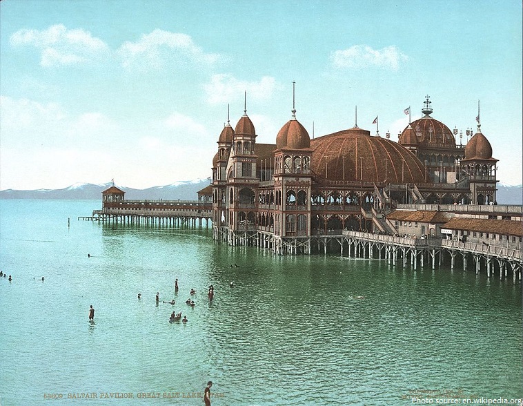
Three resorts, each called Saltair, have been operated on the southern shore of the lake since 1893, each one built as a successor to the previous one. [Photo below: The original Saltair, c. 1900]
Local legend maintains that in 1875, entrepreneur James Wickham had two whales released into the Great Salt Lake, with the intent of using them as a tourist attraction. The whales are said to have disappeared into the lake and subsequently sighted multiple times over a number of months, but there have never been any confirmed sightings of the whales since the time of their supposed release.
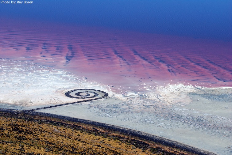
The northwest arm of the lake, near Rozel Point, is the location for Robert Smithson’s work of land art, Spiral Jetty (1970), which is only visible when the level of Great Salt Lake drops below 1,280 meters (4,200 feet) above sea level.
The existence of a large body of water in an arid region, especially a salt lake, attracted early attention.
Native American cultures used the freshwater marshes and streams around the lake for hunting and fishing.
The first European reports of the lake seem to have been by Baron Lahontan, who reported in 1703 that he had seen a region west of the Mississippi which contained a large salt lake.
The next recorded information about the lake came from the Dominguez-Escalante expedition. Reaching Utah Lake in 1776, they were informed by Indians that it was joined to a much larger lake to the north whose waters were “harmful or extremely salty wherefore . . . anybody getting a part of his body wet instantly feels severe itching around the wet part.
The Great Salt Lake is a remnant of a much larger prehistoric lake called Lake Bonneville which at its peak surface area, was nearly as large as Lake Michigan and significantly deeper, covering roughly ten times the area of Great Salt Lake. It covered much of present-day Utah and small portions of Idaho and Nevada during the Pleistocene Epoch, more commonly known as the Great Ice Age, between 32,000 and 14,000 years ago. With the change in climate, the lake began drying up, leaving the Great Salt Lake, Utah Lake, Sevier Lake, Rush Lake, and Little Salt Lake as remnants.