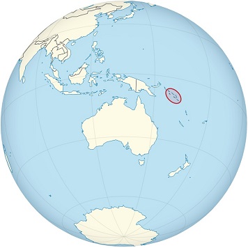
Solomon Islands is an island country located the southwestern Pacific Ocean.
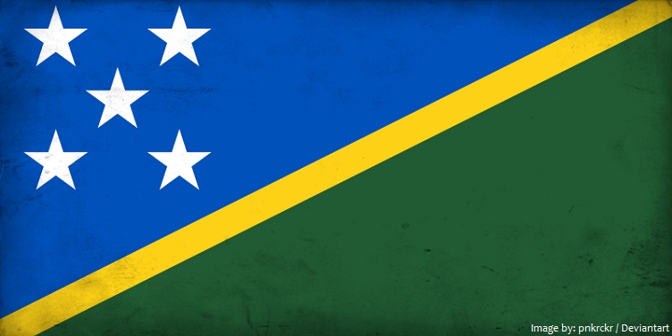
The official name of the country is Solomon Islands.
Solomon Islands shares maritime borders with Australia, Papua New Guinea, New Caledonia (France) and Vanuatu.
The country lie east of Papua New Guinea and northeast of Australia.
While English is the official language, only 1–2% of the population speak English. The number of local languages listed for Solomon Islands is 74, of which 70 are living languages and 4 are extinct, according to Ethnologue, Languages of the World.
As of 1 January 2017, the population of Solomon Islands was estimated to be 602,041 people.
It is the 139th largest country in the world in terms of land area with 28,896 square kilometers (11,000 square miles).
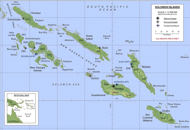
The country is made up of six major islands and over 900 smaller islands. The major islands are Guadalcanal, Choiseul, Santa Isabel, New Georgia, Malaita and Makira (or San Cristobal).
The distance between the most western and most eastern islands is about 1,500 kilometers (930 mi).
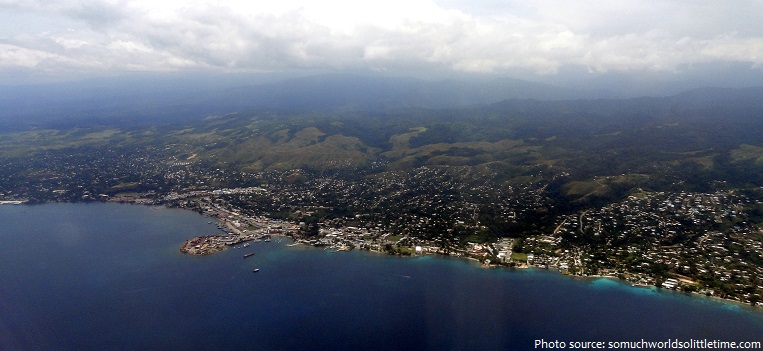
Honiara is the capital city of Solomon Islands, administered as a provincial town on the northwestern coast of Guadalcanal. The city is served by Honiara International Airport and the sea port of Point Cruz, and lies along the Kukum Highway.
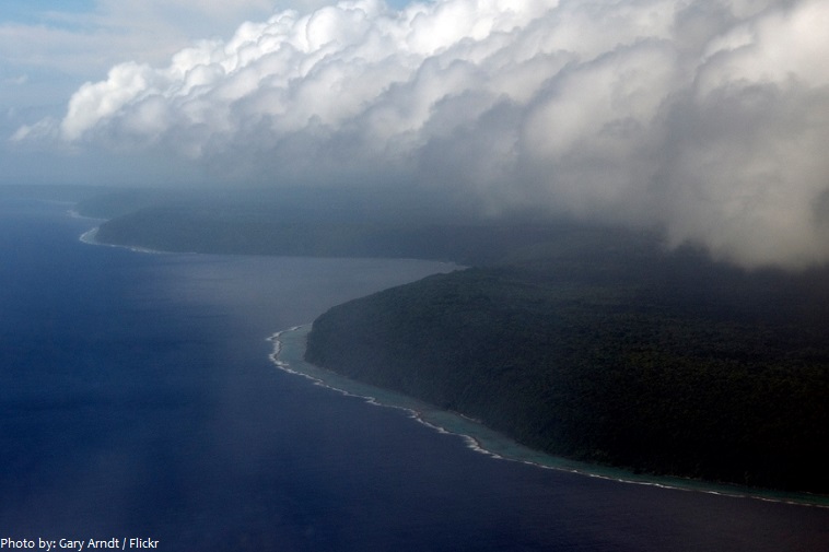
The Solomon Islands consists of a double chain of volcanic islands and coral atolls.
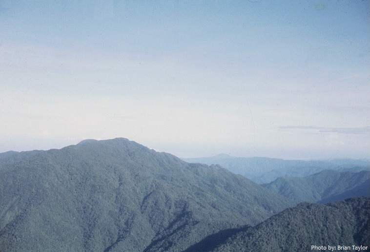
The terrain is mountainous and heavily forested.
Mount Popomanaseu is a volcanic mountain and the highest mountain in the Solomon Islands. At 2,335 meters (7,661 feet) above sea level, it is the highest peak in the insular South Pacific, excluding New Guinea and its satellite islands.
The coastline of the islands total 5,313 kilometers (3,300 miles) in length.
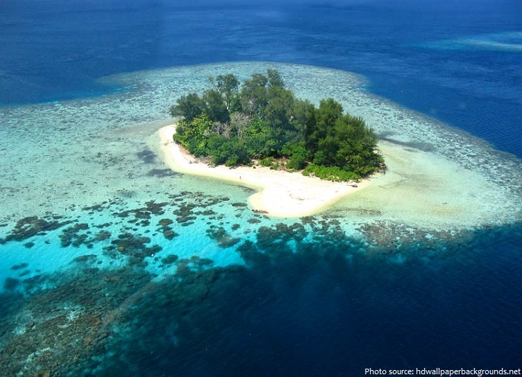
There are many splendid beaches surrounded by crystal clear water and coral reefs.
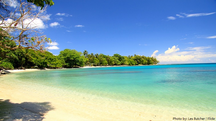
The Solomon Islands are one of the world’s top diving destinations.
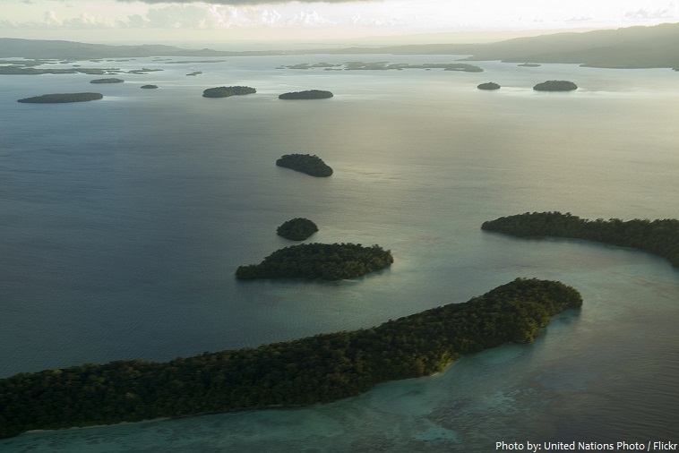
Marovo Lagoon is a large saltwater lagoon located in the New Georgia Islands, north of Vangunu Island. It is the world’s finest double-barrier-enclosed lagoon, bordered by the large New Georgia and Vangunu Islands on one side and a double line of long barrier islands on the other. It contains hundreds of beautiful small islands, most of which are covered by coconut palms and rainforest and surrounded by coral.
Rennell is the largest raised coral atoll in the world and the area in East Rennell surrounding Lake Tegano contains many endemic species.
East Rennell is the southern portion of Rennell Island and is designated a UNESCO World Heritage Site. In 2013, the World Heritage Committee added East Rennell to the List of World Heritage in Danger because of the threat of logging activities to the site’s outstanding universal value.
Kennedy Island is a small uninhabited island in the Solomon Islands that was named after John F. Kennedy, following an incident involving Kennedy during his World War II naval career.
The human history of Solomon Islands begins with the first Papuan settlement at least 30,000 years ago from New Guinea.
However, the earliest date of known human habitation has been put at 1300-1000 BC from carbon dating remains that were found in a cave on Guadalcanal.
Ships of the Spanish explorer Álvaro de Mendaña de Neira first sighted Santa Isabel island on 6 February 1568. Finding signs of alluvial gold on Guadalcanal, Mendaña believed he had found the source of King Solomon’s wealth, and consequently named the islands “The Islands of Solomon”.
In 1893, the British declared a protectorate over some of the islands in response to the German annexation of others. By 1900 Germany agreed to cede their interests to Britain and the Solomons
came entirely under British rule.
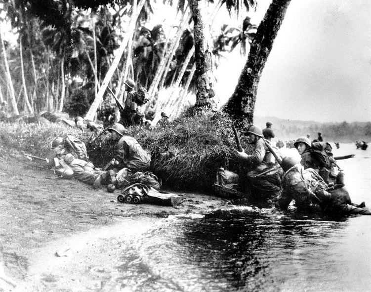
In WWII Japanese forces occupied the Solomon Islands in January 1942. The counter-attack was led by the United States; the 1st Division of the US Marine Corps landed on Guadalcanal and Tulagi in August 1942. Some of the most bitter fighting of World War II took place on the islands for almost three years.
Following the independence of neighbouring Papua New Guinea from Australia in 1975, the Solomon Islands gained self-government in 1976. Independence was granted on 7 July 1978. They remain a member of the British Commonwealth today.
Ethnic tension between natives of Guadalcanal and settlers from nearby Malaita island escalated into armed conflict from 1998 until 2003, when an Australian-led peacekeeping force restored order.
Solomon Islands’ economy is based on agriculture, forestry and fisheries, which together account for around 40 per cent of GDP and provide employment for the majority of the population.
Fish is the staple meat in the Solomon Islands cuisine. Usually any meat is cooked and served with sweet potatoes, rice, taro roots, cassava, taro leaves and many other vegetables. Beside the local
traditional cuisine many dishes from both European and Asian culture can be easily found and served in any restaurant or household of this country.
The islands’ ocean-equatorial climate is extremely humid throughout the year, with a mean temperature of 26.5 °C (79.7 °F).
The religion of Solomon Islands is mainly Christian (comprising about 92% of the population).
Indigenous mammals are small and include opossums, bats and mice. There are crocodiles in the mangrove swamps and sea turtles nest on the shores from November to February. There are more than 150 species of birds including many species of parrot and incubator bird.