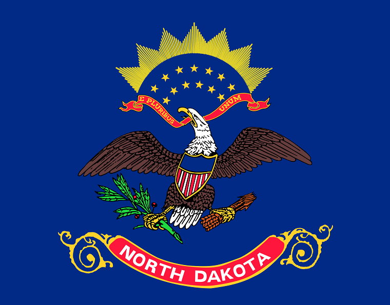
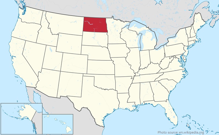
North Dakota is a state in the midwestern and northern regions of the United States.
It is bordered by Minnesota to the east South Dakota is to the south, Montana is to the west, and Canada is to the north.
As of October 2018, the population of North Dakota was estimated to be about 760,000 people. It is the 47th most populous state in the United States.
North Dakota is the 19th largest state in the United States in terms of total area with 183,843 square kilometers (70,762 square miles).
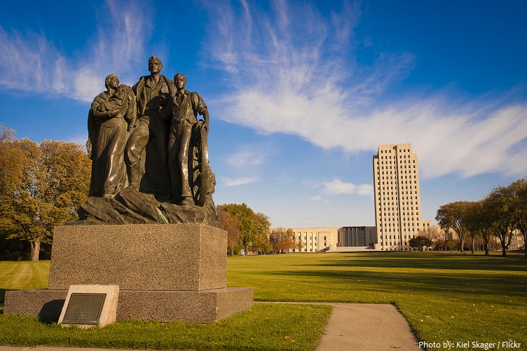
Bismarck is the capital city of North Dakota. It is the second-most populous city in North Dakota after Fargo. In 2017, Forbes magazine ranked Bismarck as the seventh fastest-growing small city in the United States.
From east to west, North Dakota is divided into three geographic regions. In the east is the Red River Valley. To the west of the Red River Valley is the Drift Prairie. The southwestern half of North Dakota is covered by the Great Plains.
North Dakota’s most important river is the Missouri; it rises in southern Montana in the Rocky Mountains, first flowing north then generally southeast across the heart of the United States, ending at the Mississippi River, just to the north of St. Louis, Missouri.
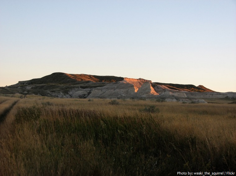
White Butte is the highest natural point of North Dakota. At an elevation of 1,069 meters (3,506 ft), it is a prominent butte in Slope County, in the Badlands of the southwestern part of the state. The lowest point in North Dakota is the Red River at 228 meters (750 feet) above sea level.
North Dakota has 3 national parks and 13 state parks.
Theodore Roosevelt National Park is an American national park comprising three geographically separated areas of badlands in western North Dakota. The park was named for U.S. President Theodore Roosevelt. The park covers 70,446 acres (28,508 hectars) or 285 square kilometers (110 square miles) of land in three sections: the North Unit, the South Unit, and the Elkhorn Ranch Unit. It is the only American national park named directly after a single person.

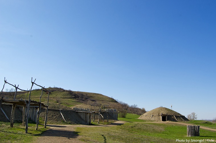
Fort Abraham Lincoln State Park is a North Dakota state park located 7 miles (11 km) south of Mandan. The park is home to the On-A-Slant Indian Village and reconstructed military buildings including the Custer House. On-A-Slant Mandan Village was established in the late 16th century and was inhabited until c. 1781. During those years the Mandan tribe had between seven and nine villages (all located along the Missouri River), with an estimated total population of 10,000 to 15,000.
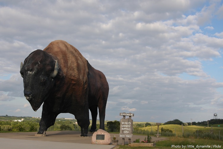
The world’s largest, albeit concrete, bison can be seen from afar at the Bison Monument and Frontier Village at the I 94, by Jamestown between Bismarck and Fargo. The structure is 8 meters (26 feet) high, 14 meters (46 feet) long, and weighs 55 tonnes (60 Us tons). Its living contemporaries graze at its feet; among them are rare albino bison. Also on-site is the National Buffalo Museum, where visitors can learn everything about the great beasts that once roamed the American West.
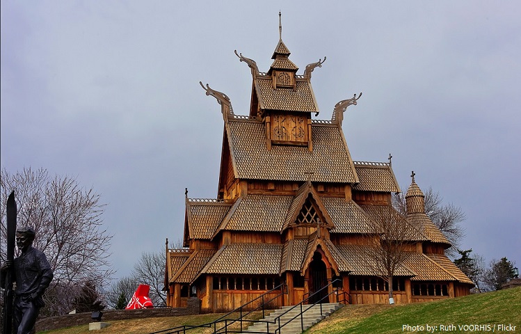
Scandinavian Heritage Park is a park located in the Upper Brooklyn neighborhood of Minot. Scandinavian Heritage Park features remembrances and replicas from each of the Scandinavian countries: Norway, Sweden and Denmark, as well as Finland and Iceland. The park was established during 1988 to celebrate and preserve Scandinavian heritage.
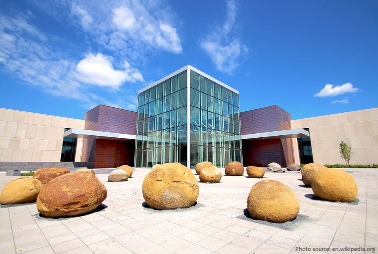
Located in Bismarck, the North Dakota Heritage Center offers an overview of the history of North Dakota from prehistoric to modern times. Visitors to the Heritage Center can choose from four museum galleries to peruse, which contain thousands of different exhibits, artifacts, and displays, ranging from a Tyrannosaurus Rex skeleton cast to a scale model of the Hubble Space Telescope.
Native American peoples lived in what is now North Dakota for thousands of years before the coming of Europeans.
The first Europeans explored the area in the 18th century establishing some limited trade with the natives.
The land that today makes up North Dakota became U.S.territory as part of the Louisiana Purchase of 1803.
When Dakota Territory was created in 1861 it was named for the Dakota Indian tribe.
North Dakota earned its star on the American flag on Nov. 2, 1889, becoming the 39th or 40th state as it was admitted to the union along with South Dakota.
An attempt to drop the word North from the state name was defeated by the 1947 Legislative Assembly. Again in 1989 the Legislature rejected two resolutions intended to rename the state Dakota.
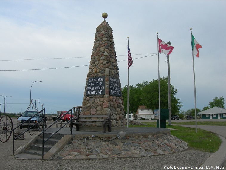
The town of Rugby is the geographical center of North America. A rock obelisk about 4.6 meter (15 feet) tall, flanked by poles flying the United States and Canadian flags marks the location.
North Dakota has the most churches per capita of any state. Additionally, North Dakota has the highest percentage of church-going population of any state.
The record for the most people making snow angels simultaneously is 8,962 at the State Capitol Grounds in Bismarck, North Dakota for an event organized by the State Historical Society of North Dakota on 17 February 2007.
North Dakota has had several nicknames, including Flickertail State, Roughrider State, and Peace Garden State.
North Dakota grows more sunflowers than any other state.
Milk is the official state beverage.