Mauritius is an island nation in the Indian Ocean about 2,000 kilometers (1,200 miles) off the southeast coast of the African continent.
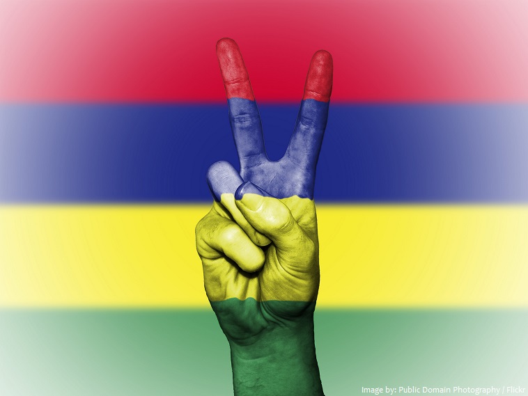
The official name of the country is the Republic of Mauritius.
Its nearest neighbors are: Reunion Island which belongs to France, 220 km (137 mi) away and the big island of Madagascar, 805 km (500 mi) away.
The official language is English.
As of 1 January 2017, the population of Mauritius was estimated to be 1,281,103 people.
It is the 170th largest country in the world in terms of land area with 2,040 square kilometers (790 square miles).
The country includes the islands of Mauritius and Rodrigues and the outer islands.
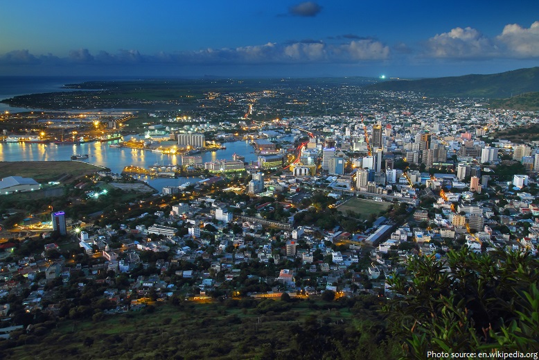
Port Louis is the capital and largest city of Mauritius. The city is the country’s economic, cultural and political center and most populous city.
The main island, from which the country derives its name is relatively young geologically, having been created by volcanic activity some 8 million years ago. The island of Mauritius is 65 km (40 mi) long and 45 km (30 mi) wide. Its land area is 1,864.8 sq km (720 sq mi).
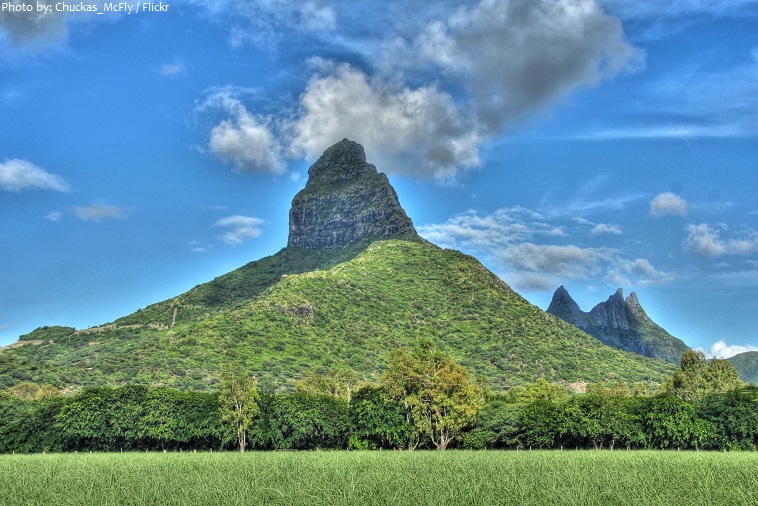
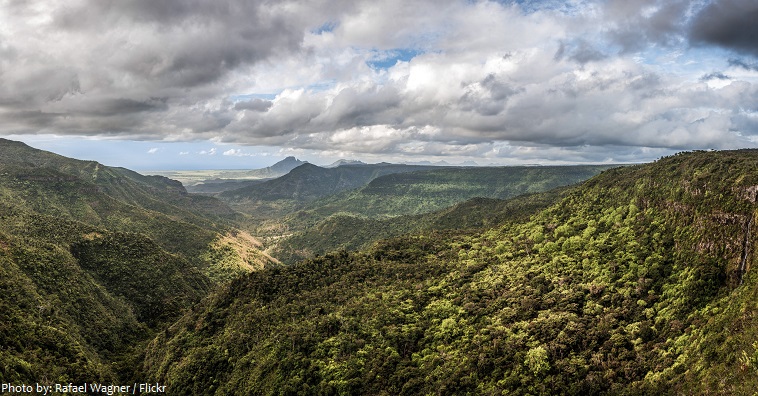
Rising from the coastal plains, much of the island is bordered by a broken ring of mountain ranges with streams and rivers flowing through ancient cracks formed by the flow of lava.
The second largest island is Rodrigues with an area of 108 sq km (42 sq mi).
Piton de la Petite Rivière Noire is the highest mountain in Mauritius rising to a height of 828 meters (2,717 feet) above sea level.
The coastline of the islands total 177 kilometers (109 miles) in length.
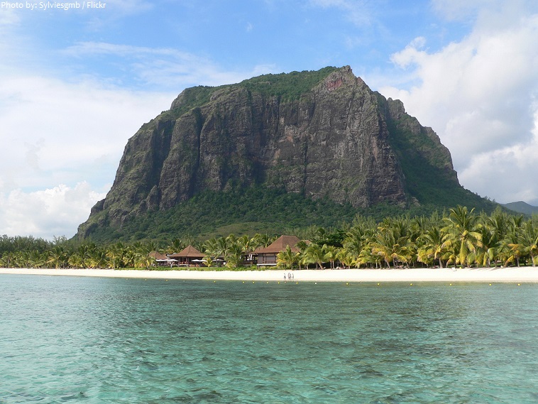
Clear warm colored blue turquoise water, and endless white beaches with coconut trees make Mauritius an ideal tropical dream beach holiday destination.
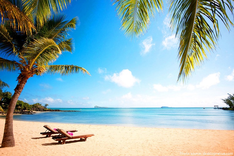
White sandy beaches that surround the coastline of Mauritius are protected from the ocean by the third largest coral reef in the world.
Nearly a hundred uninhabited islets and rocks dot the waters off the coast, and are a popular weekend spot for locals and tourists alike.
The network of protected areas in Mauritius covers about 5% of the national territory. It is made up of 3 national parks, 18 nature reserves plus other types of protected areas.
Black River Gorges National Park is a national park in the hilly south-western part of Mauritius. It was proclaimed on June 15, 1994 and is managed by the National Parks and Conservation Service. It covers an area of 67.5 square kilometers (26 square miles) including humid upland forest, drier lowland forest and marshy heathland. Facilities for visitors include two information centers, picnic areas and 60 kilometers of trails.
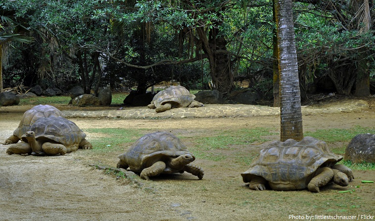
In the south of Mauritius, La Vanille Nature Park lies on 3.5 hectares (8.6 acres) of luxuriant vegetation where guests can find geckos, macaques, deer, and mongooses. This part of the island has kept a feeling of “old Mauritius,” whether it is the manner of the people, their traditions, or even the unspoiled scenery. It is the largest Giant Aldabra tortoises’ center of reproduction in the world, with more than 700 tortoises of all ages roaming in liberty.
Mauritius has 2 UNESCO world heritage sites.
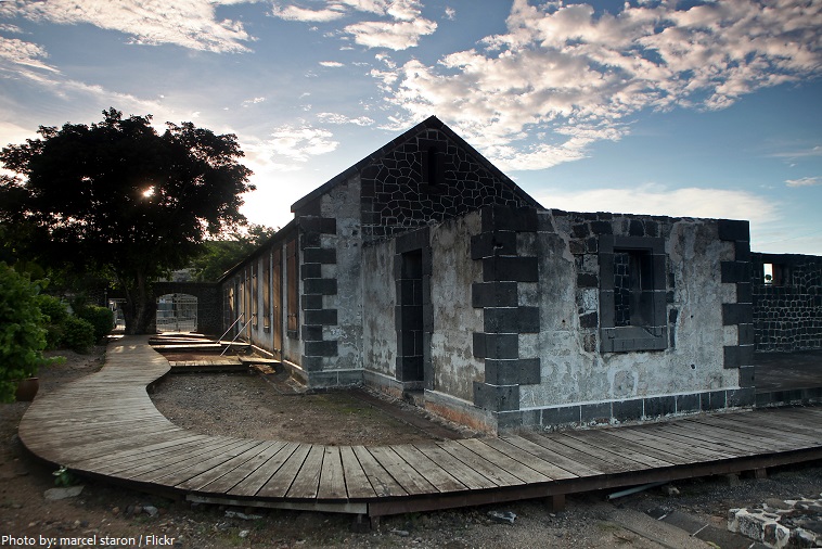
The Immigration Depot (Aapravasi Ghat) is a building complex located in Mauritius’s capital, Port Louis. From 1849 to 1923, half a million Indian indentured labourers passed through the Immigration Depot, to be transported to plantations throughout the British Empire. The large-scale migration of the laborers left an indelible mark on the societies of many former British colonies, with Indians constituting a substantial proportion of their national populations. The Immigration Depot’s role in social history was recognized by UNESCO when it was declared a World Heritage Site in 2006.
Le Morne Cultural Landscape, a rugged mountain that juts into the Indian Ocean in the southwest of Mauritius was used as a shelter by runaway slaves, maroons, through the 18th and early years of the 19th centuries. Protected by the mountain’s isolated, wooded and almost inaccessible cliffs, the escaped slaves formed small settlements in the caves and on the summit of Le Morne. The oral traditions associated with the maroons, have made Le Morne a symbol of the slaves’ fight for freedom, their suffering, and their sacrifice, all of which have relevance to the countries from which the slaves came – the African mainland, Madagascar, India, and South-east Asia. It was inscribed as a UNESCO World Heritage Site in 2008.
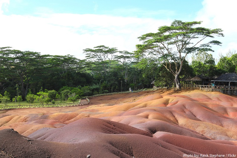
The Seven Colored Earths are a geological formation and prominent tourist attraction located in south-western part of the island of Mauritius. It is a relatively small area of sand dunes comprising sand of seven distinct colors (approximately red, brown, violet, green, blue, purple and yellow). The main feature of the place is that since these differently colored sands spontaneously settle in different layers, dunes acquire a surrealistic, striped coloring. Another interesting feature of Chamarel’s Coloured Earths is that the dunes seemingly never erode, in spite of Mauritius’ torrential tropical rains.
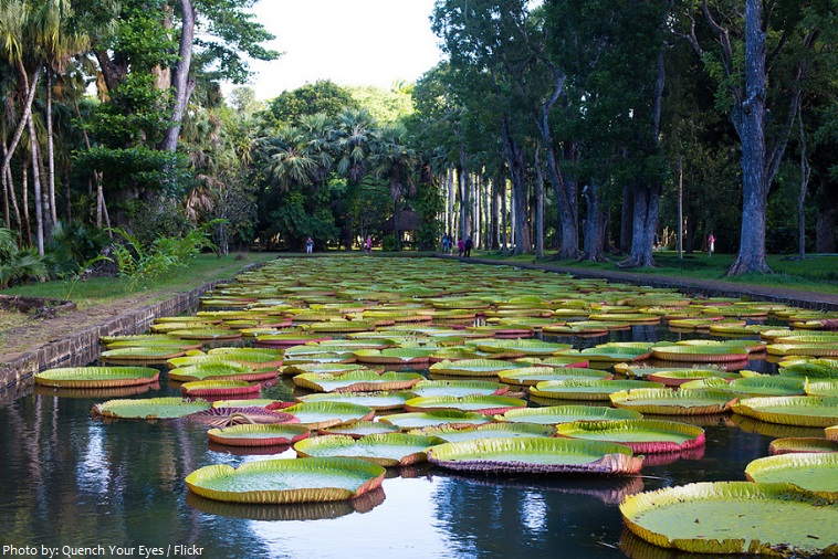
The Sir Seewoosagur Ramgoolam Botanical Garden, commonly known as the Pamplemousses Botanical Garden, is a popular tourist attraction in Pamplemousses, near Port Louis, and the oldest botanical garden in the Southern Hemisphere. Famous for its long pond of giant water lilies, the garden was first constructed by Pierre Poivre (1719 – 1786) in 1770, and it covers an area of around 37 hectares (91 acres).
The known history of Mauritius begins with its discovery by Arabs, followed by Europeans and its appearance on maps in the early 16th century.
Portuguese sailors first visited in the 16th century, the island was first colonized in 1638 by the Dutch. There were Dutch settlers from 1638 until 1710. The island was named in honor of Prince Maurice of Nassau by the Dutch, who abandoned the colony in 1710.
The French took formal possession in 1715 and sent settlers from 1721; the French East India Company governed the island, called Île de France, from about 1767.
In 1810, Mauritius was captured by the British, whose possession of the island was confirmed 4 years later by the Treaty of Paris.
Mauritius became independent on March 12, 1968.
Since independence from Britain, Mauritius has developed from a low-income, agriculture-based economy to a middle-income diversified economy, based on tourism, textiles, sugar, and financial services.
The economic history of Mauritius since independence has been called “the Mauritian Miracle” and the “success of Africa.”
The cuisine of Mauritius is a blend of Chinese, European and Indian influences in the history of Mauritius. Dishes from French cuisine have grown very popular in Mauritius. Most of the dishes and
practices into the culinary traditions are inspired from former slaves, Indian workers and Chinese migrant during the 19th century.
Mauritius is a religiously diverse nation with Hinduism being the religion of about half the population. It is the only country in Africa where Hinduism is the largest religion.
The most popular sport in Mauritius is football.
Mauritius is former home of the dodo, a large flightless bird related to pigeons, driven to extinction by the end of the 17th century through a combination of hunting and the introduction of predatory species.
Mark Twain once said: “You gather the idea that Mauritius was made first and then heaven, and that heaven was copied after Mauritius.”