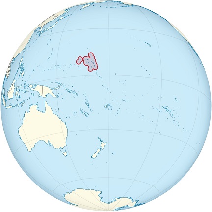
The Marshall Islands is an island nation in the central Pacific Ocean.
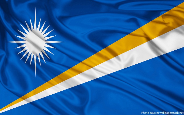
The official name of the country is the Republic of the Marshall Islands.
The islands are located about halfway between Hawaii and Australia.
Geographically, the country is part of the larger island group of Micronesia.
As an island nation, Marshall Islands shares no land borders. However, nearby islands include Wake Island (north), Kiribati (south-east), Nauru (south), and the Federated States of Micronesia (west).
The Marshall Islands has two official languages: Marshallese and English.
As of 1 January 2017, the population of Marshall Islands was estimated to be 55,036 people.
It is the 189th largest country in the world in terms of land area with 181 square kilometers (70 square miles).
The Marshall Islands are scattered over a vast area of ocean about 1.9 million square kilometers (730,000 square miles); equivalent in size to Mexico.
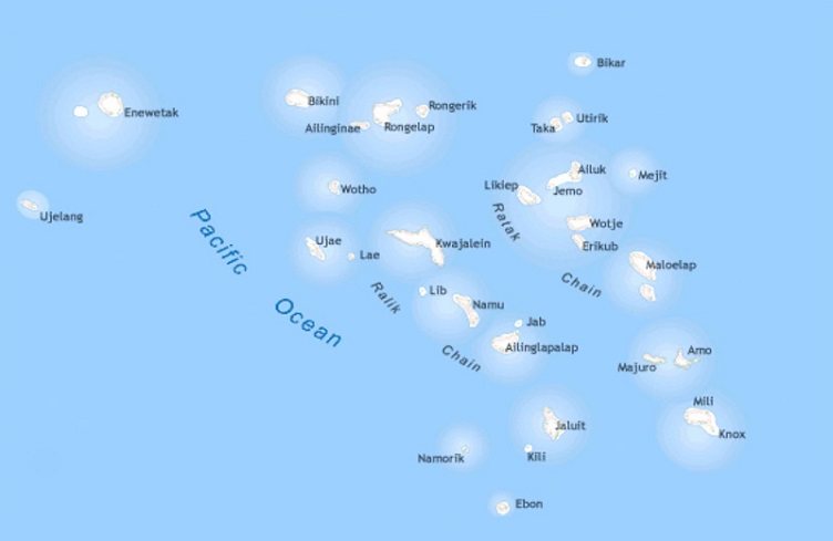
The Marshall Islands include the Ratak (means “sunrise”) and Ralik (means “sunset”), two parallel chains of 29 coral atolls, thousands of tiny islets, and hundreds of very small low-lying islands, all scattered over a wide area of the Pacific Ocean.
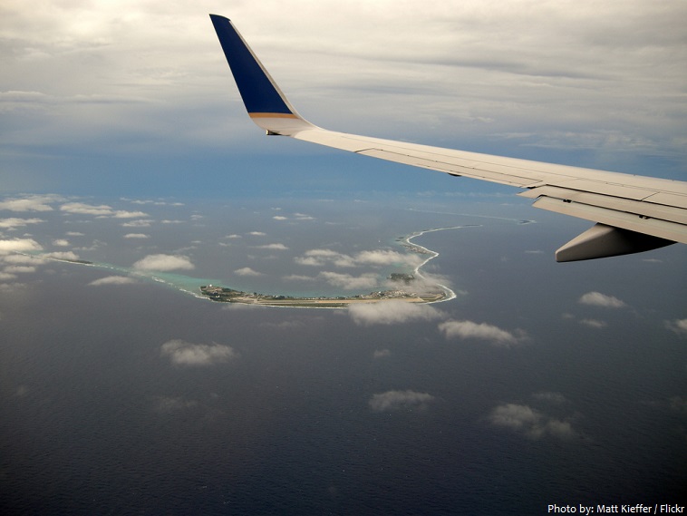
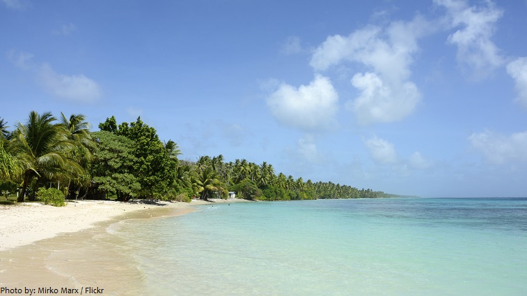
The Marshall Islands are slivers of white sand beaches and lush green vegetation, serenely protected by light blue lagoons and thriving coral reefs.
Twenty-four of the atolls and islands are inhabited.
The largest atoll with a land area of 16 square kilometers (6 square miles) is Kwajalein. It surrounds
a 1,700-square-kilometer (655-square-mile) lagoon.
Likiep Atoll also possesses the Marshall Islands’ highest point, an unnamed knoll 10 meters (33 feet) above sea level.
The average altitude above sea level for the entire country is only 2.1 meters (7 feet).
The coastline of the islands total 370 kilometers (230 miles) in length.
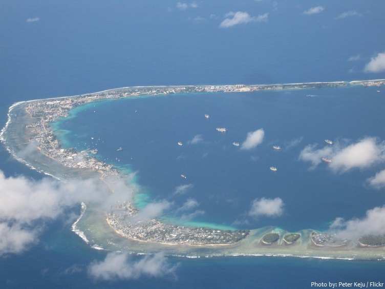
Majuro is the capital and largest city of the Republic of the Marshall Islands. It is also a large coral atoll of 64 islands. Majuro has a port, shopping district, hotels, and an international airport.
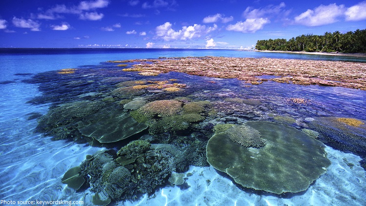
The clear-blue waters, surrounding the Marshall Islands are home to over 1,000 species of fish and more than 250 species of soft and hard corals. With crystal clear visibility, dramatic drop-offs and several wrecks to explore, it’s considered one of the best places in the world to scuba dive.
In October 2011, the government declared that an area covering nearly 2,000,000 square kilometers
(772,000 sq mi) of ocean shall be reserved as a shark sanctuary. This is the world’s largest shark
sanctuary, extending the worldwide ocean area in which sharks are protected from 2,700,000 to
4,600,000 square kilometers (1,042,000 to 1,776,000 sq mi).
Micronesians settled the Marshall Islands in the 2nd millennium BC, but there are no historical or oral records of that period. Over time, the Marshall Island people learned to navigate over long ocean distances by canoe using traditional stick charts.
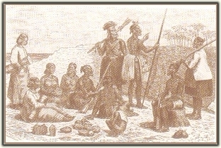
Spanish explorer Alonso de Salazar was the first European to see the islands in 1526, commanding the ship Santa Maria de la Victoria.
The islands derive their name from British explorer John Marshall, who visited in 1788. The islands were historically known by the inhabitants as “jolet jen Anij” (Gifts from God).
The European powers recognized Spanish sovereignty over the islands in 1874. Later, Spain sold the
islands to the German Empire in 1884, and they became part of German New Guinea in 1885.
In World War I the Empire of Japan occupied the Marshall Islands, which in 1919 the League of Nations combined with other former German territories to form the South Pacific Mandate.
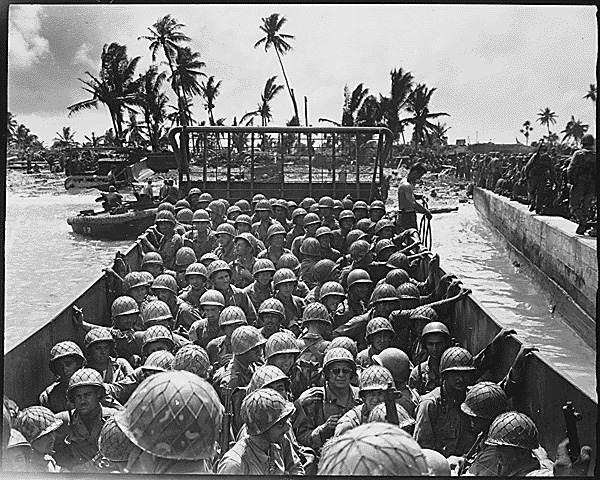
In World War II, the United States, during the Gilbert and Marshall Islands campaign, invaded and
occupied the islands in 1944.
In 1947, the UN made the Marshall Islands, along with several other island groups located in Micronesia, a U.S. trust territory.
In 1979, the Government of the Marshall Islands was officially established and the country became self-governing.
In 1986, the Compact of Free Association with the United States entered into force, granting the Republic of the Marshall Islands (RMI) its sovereignty.
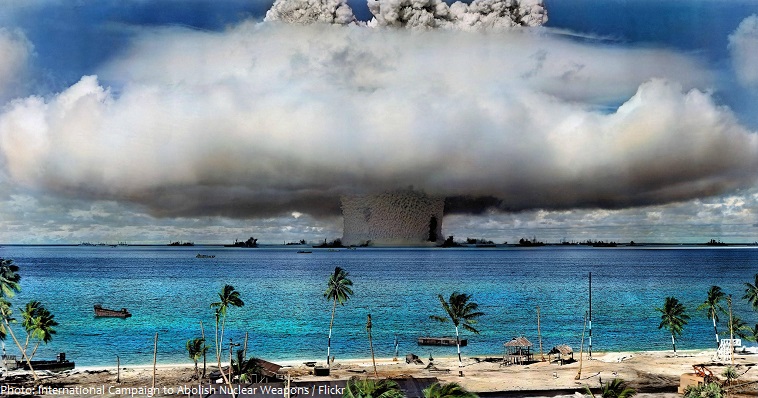
From 1946 to 1958, the early years of the Cold War, the United States tested 67 nuclear weapons at its Pacific Proving Grounds located in the Marshall Islands, including the largest atmospheric nuclear test ever conducted by the U.S., code named Castle Bravo.
From 1956 to August 1998, at least $759 million was paid to the Marshallese Islanders in compensation for their exposure to U.S. nuclear weapon testing.
Due to its very low elevation, the Marshall Islands are threatened by the potential effects of sea level rise.
The Marshall Islands are the most endangered nation in the world due to flooding from climate change.
The Marshall Islands’ weather is hot, humid, rainy, and fairly predictable.
The temperatures on the islands remain quite stable year round as daily lows hover around 24° C (75° F) and day time highs usually peak at about 30° C (86° F) for the entire country.
As an island nation the number of native plants and animals in the Marshall Islands are severely limited. The native land life is almost non-existent and the native plant life was very limited; only the migrating birds and sea life had any significant presence in the historic Marshall Islands.
As an island nation that rose from the sea floor there were no native mammals in the Marshall Islands, although a few bat species arrived thousands of years ago.
The islands have few natural resources, and their imports far exceed exports.
Over 90% of the value of exports is accounted for by fish, coconut oil, and copra (dried coconut meat).
The majority of the citizens of the Marshall Islands are of Marshallese descent, though there are small numbers of immigrants from the United States, China, Philippines, and other Pacific islands.