Mali is a landlocked country in West Africa.
The official name of the country is the Republic of Mali.
It is bordered by Algeria to the northeast, Niger to the east, Burkina Faso and Ivory Coast to the south, Guinea to the south-west, and Senegal and Mauritania to the west.
The official language is French.
As of 1 January 2017, the population of Mali was estimated to be 18,388,322 people.
With an area of 1,240,192 square kilometers (478,841 square miles), Mali is the 23th largest country in the world, and the 8th largest in Africa.
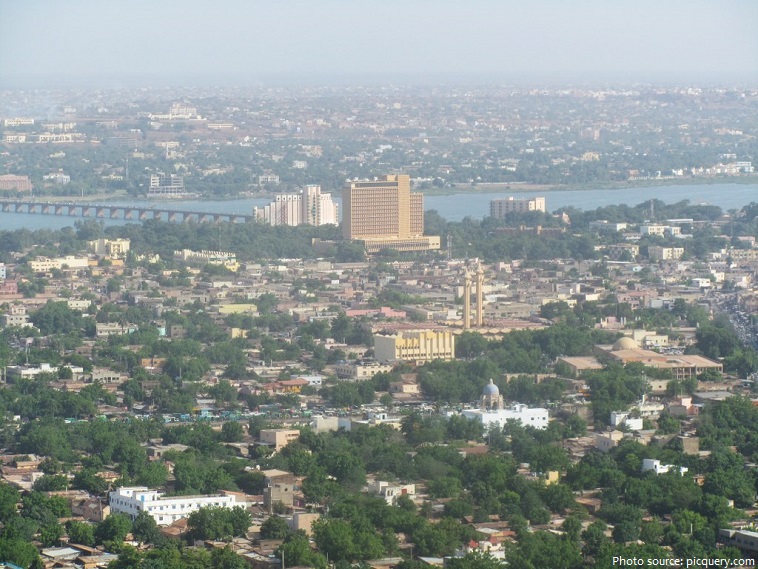
Bamako is the capital and largest city of Mali. It is located on the Niger River, near the rapids that divide the upper and middle Niger valleys in the southwestern part of the country. The name Bamako comes from the Bambara word meaning “crocodile tail”.
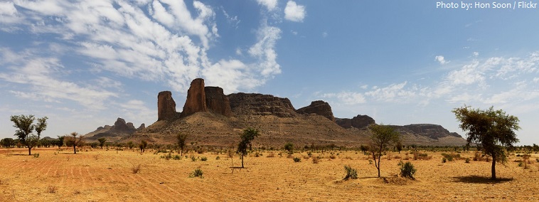
Most of the country lies in the southern Sahara Desert, which produces an extremely hot, dust-laden Sudanian savanna zone.
Desert or semi-desert covers about 65 percent of Mali’s area.
The country’s terrain is primarily savanna in the south and flat to rolling plains or high plateau (200–500 meters / 650-1640 feet in elevation) in the north. There are rugged hills in the northeast, with elevations of up to 1,000 meters (3280 feet).
Mount Hombori is a mountain in Mali’s Mopti Region, near the town of Hombori. At 1,153 meters (3,783 feet), it is the highest point in Mali. Mount Hombori is a significant archaeological site, with caves inhabited more than 2,000 years ago.
The largest rivers in Mali are the Niger and Senegal. Considered to be Mali’s lifeblood (its source of food, drinking water, irrigation and transportation) the Niger River snakes through roughly 4,180 kilometers (2,600 miles) of western Africa.
The network of protected areas in Mali covers about 8% of the national territory. It is made up of 4 national parks, plus other types of protected areas.
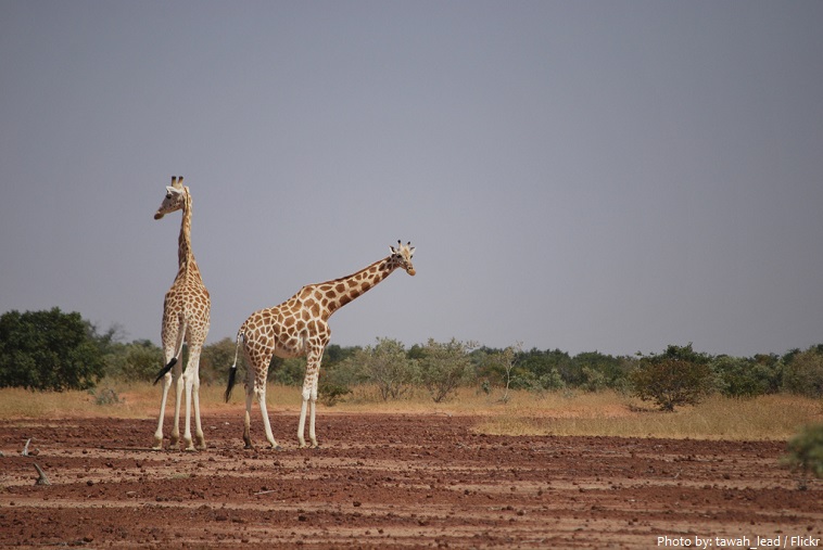
The Boucle du Baoulé National Park lies in western Mali. The park was established in 1982 and has an area of 25,330 square kilometers (9,780 square miles). The prehistoric tombs and rock art situated throughout the national park are just as impressive as the giraffes, elephants, leopards, and lions who roam its vast territory.
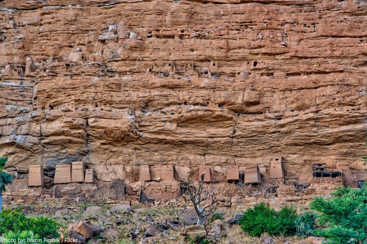
The Bandiagara Escarpment (Cliffs of Bandiagara) is an escarpment in the Dogon country of Mali. The sandstone cliff rises about 500 meters (1,640 feet) above the lower sandy flats to the south. It has a length of approximately 150 kilometers (93 miles). The area of the escarpment is inhabited today by the Dogon people. Before the Dogon, the escarpment was inhabited by the Tellem and Toloy peoples. Many structures remain from the Tellem. The Bandiagara Escarpment was listed in the UNESCO World Heritage List in 1989.
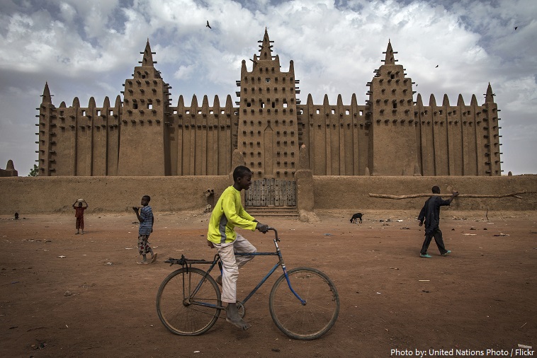
The Great Mosque of Djenné is a large banco or adobe building that is considered by many architects to be one of the greatest achievements of the Sudano-Sahelian architectural style. The mosque is located in the city of Djenné, on the flood plain of the Bani River. The first mosque on the site was built around the 13th century, but the current structure dates from 1907. As well as being the center of the community of Djenné, it is one of the most famous landmarks in Africa. Along with the “Old Towns of Djenné” it was designated a World Heritage Site by UNESCO in 1988.
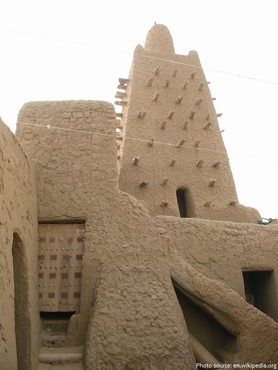
The Djinguereber Mosque in Timbuktu, is a famous learning center of Mali built in 1327. Its design is accredited to Abu Es Haq es Saheli who was paid 200 kg (40,000 mithqals) of gold by Musa I of Mali, emperor of the Mali Empire. Djinguereber is one of four madrassas composing the University of Timbuktu. It was inscribed on the list of UNESCO World Heritage Sites in 1988, and in 1990 was considered to be in danger due to sand encroachment.
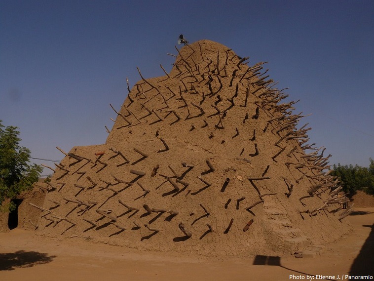
The Tomb of Askia, in Gao, is believed to be the burial place of Askia Mohammad I, one of the Songhai Empire’s most prolific emperors. It was built at the end of the fifteenth century and is designated as a UNESCO World Heritage Site in 2004.
The Aga Khan Foundation financed the National Park of Mali in the heart of bustling Bamako. His Highness Aga Khan designed this sprawling and serene park which includes a traditional medicine garden, tea house, playground, and two restaurants. Park visitors can work out at the fully-equipped gym, jog along gravel paths or simply watch the world go by while nibbling on croissants.
Mali is the cultural heir to the succession of ancient African empires – Ghana, Malinké, and Songhai – that occupied the West African savannah.
By the middle of the nineteenth century (1855 onwards), the French began conquering the area, which came to form part of ‘French West Africa’.
By 1946, it was known as the ‘French Sudan’, an overseas territory of the French Union.
In 1958, the country was joined with Senegal to form the Mali Federation. However Senegal split from this union and in 1960 the independent Republic of Mali was born.
As the country struggled economically, unpopular governments were overthrown by the military in 1968 and 1991, when civilian government was restored.
The economy of Mali is based to a large extent upon agriculture, with a mostly rural population engaged in subsistence agriculture.
Cotton is the country’s largest crop export and is exported west throughout Senegal and Ivory Coast.
Mali is one of the poorest countries in the world.
Rice and millet are the staples of Malian cuisine, which is heavily based on cereal grains.
Islam was introduced to West Africa in the 11th century and remains the predominant religion in much of the region. An estimated 90 percent of Malians are Muslim , approximately 5 percent are Christian and the remaining 5 percent adhere to indigenous or traditional animist beliefs.
Mali is renowned worldwide for having produced some of the stars of African music, most notably Salif Keita.
The most popular sport in Mali is football.