Kiribati is an island nation in the central Pacific Ocean.
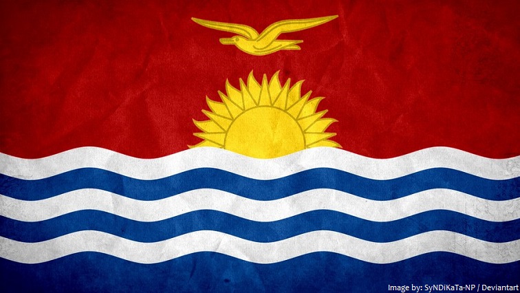
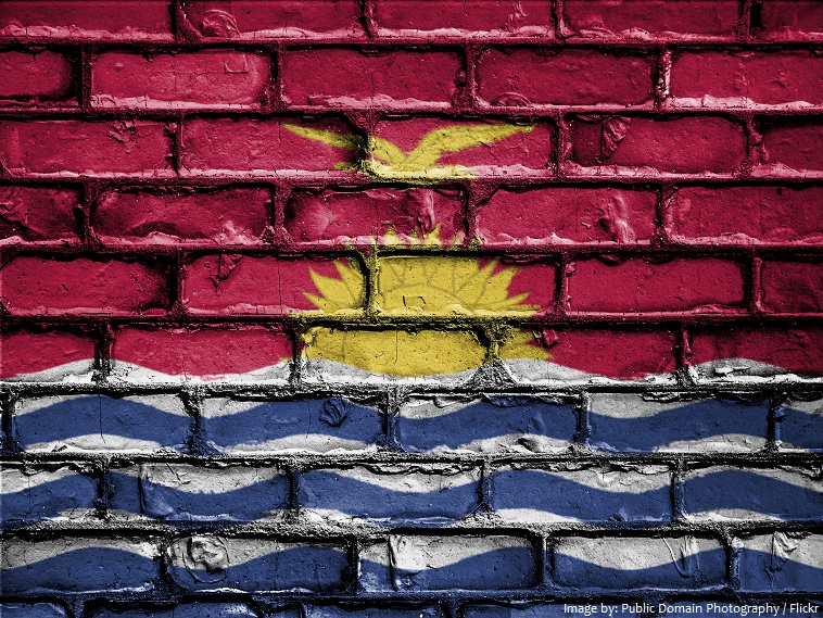
The official name of the country is the Republic of Kiribati.
The islands are located roughly halfway between Hawaii and Australia in the Micronesian region of the South Pacific.
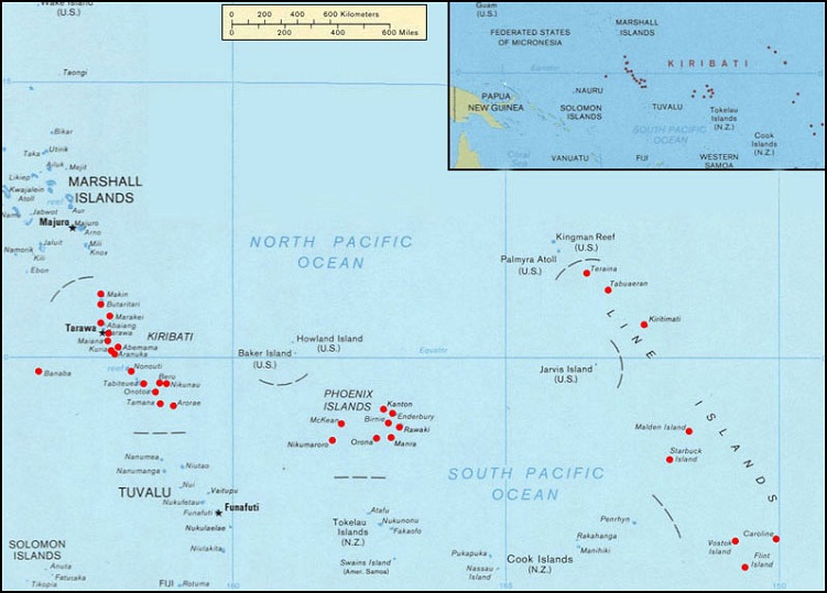
As an island nation, Kiribati shares no land borders. However, nearby islands include Fiji, Nauru, Marshall Islands, Samoa, French Polynesia, Cook Islands, and Tonga.
Kiribati has two official languages: Kiribati and English.
As of 1 January 2017, the population of Kiribati was estimated to be 115,536 people.
It is the 178th largest country in the world in terms of land area with 800 square kilometers (310 square miles).
Kiribati are scattered over a vast area of ocean about 3.5 million square kilometers (1,351,000 square miles); equivalent in size to the continental United States.
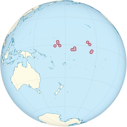
Kiribati consists of 32 atolls and one solitary island (Banaba), extending into the eastern and western hemispheres, as well as the northern and southern hemispheres. It is the only country that is situated within all four hemispheres.
Of the 33 islands of Kiribati, 21 are inhabited.
The three main island groupings are the Gilbert Islands, Phoenix Islands, and Line Islands.
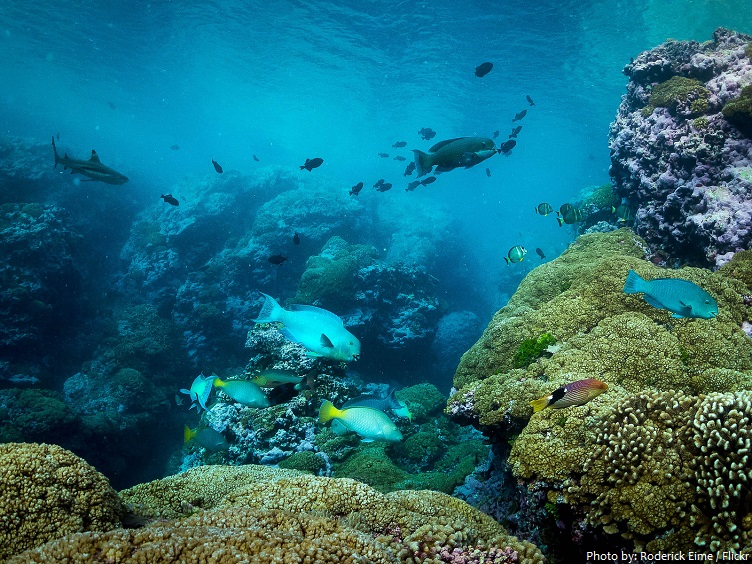
The Phoenix Islands Protected Area, is one of the largest marine protected areas on Earth. (was largest from 2008 to 2010). It is home to some 120 species of coral and more than 500 species of fish.
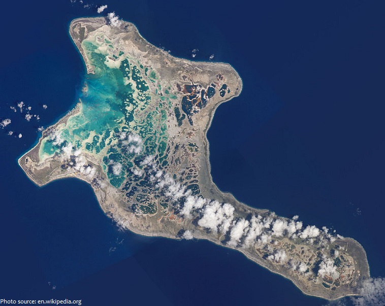
Kiribati includes Kiritimati (Christmas Atoll; in the Line Islands), the largest coral atoll (in terms of land area, not dimensions) in the world. It has land area of about 388 square kilometers (150 square miles).
Banaba Island has an area of 6 square kilometers (2.3 square miles), and the highest point on the island is also the highest point in Kiribati, at 81 meters (266 feet) above sea level.
South Tarawa is the capital and hub of the Republic of Kiribati and home to approximately half of Kiribati’s total population. The South Tarawa population center consists of all the small islets from Betio in the West to Bonriki in the East, connected by the South Tarawa main road.
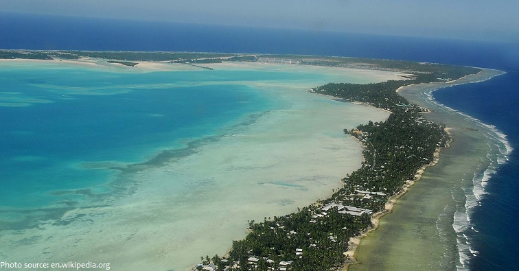
The coastline of the islands total 1,143 kilometers (710 miles) in length.
The beaches are sandy and often pristine white, and there are lush forests on many of the islands.
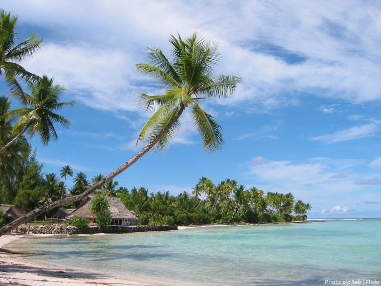
Due to its location, Kiribati exhibits a maritime climate. Temperatures range between 26-32 °C (79-90 °F) year-round, with the water temperature sitting on a comfortable year-round 28-29 °C (82-84 °F).
The isolated location of the Kiribati islands prevents tourism from flourishing, and becoming a major business, even though the weather is consistently warm, offshore reefs teem with colorful fish, and WWII shipwrecks are commonplace, especially off the eastern edge of Kiritimati.
Kiribati has a few land mammals, none being indigenous or endemic. They include the Polynesian rat (Rattus exulans), dogs and pigs.
Among the 75 bird species, the Bokikokiko (Acrocephalus aequinoctialis) is endemic to Kiritimati.
There are 600–800 species of inshore and pelagic finfish, some 200 species of corals and about 1000 species of shellfish.
The area now called Kiribati has been inhabited by Micronesians speaking the same Oceanic language since sometime between 3000 BC and AD 1300.
Fijians and Tongans arrived about the 14th century and subsequently merged with the older groups to form the traditional I-Kiribati Micronesian society and culture.
Chance visits by European ships occurred in the 17th and 18th centuries, as these ships attempted circumnavigations of the world or sought sailing routes from the south to north Pacific Ocean.
A British protectorate since 1892, the Gilbert and Ellice Islands became a Crown colony in 1915–1916. Kiritimati (Christmas) Atoll became a part of the colony in 1919; the Phoenix Islands were added in 1937.
The Gilbert Islands gained independence as the Republic of Kiribati on 12 July 1979.
Much of the natural resources have been exhausted before its 1979 independence.
Copra and fish now represent the bulk of production and exports. Kiribati is considered one of the least developed countries in the world.
Christianity is the major religion in Kiribati, having been introduced by missionaries in the 19th century.
On 1 January 1995 Kiribati moved the International Date Line to include its easternmost islands and make it the same day throughout the country.
Prior in 1994, the eastern and western islands groups were on either side of the International Dateline with a 23-hour time difference between them.
Located just to the west of the International Date Line, the Republic of Kiribati is one of the first places on Earth to see the first rays of the rising sun. Their time zone is 14 hours ahead of UTC – the farthest forward time zone in the world.
Kiribati saw some of the worst fighting of the Pacific theatre during the Second World War, including the infamous Battle of Tarawa in November 1943.
Nuclear weapons testing including hydrogen bombs were conducted on and around Kiribati by the United Kingdom in the late 1950s, and by the United States in 1962. During these tests islanders were not evacuated.