Guinea-Bissau is a country on the western coast of Africa.
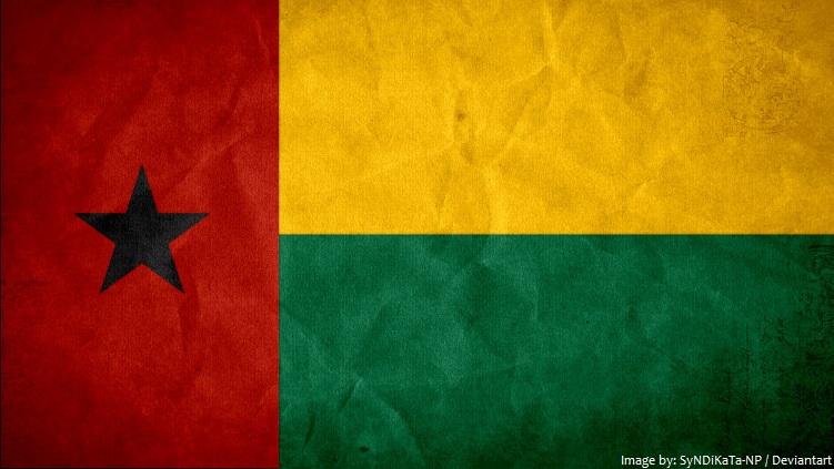
The official name of the country is the Republic of Guinea-Bissau.
It is bordered by Senegal to the north and Guinea to the south and east, with the Atlantic Ocean to its west.
The official language is Portuguese.
As of 1 January 2017, the population of Guinea-Bissau was estimated to be 1,911,580 people.
It is the 134th largest country in the world in terms of land area with 36,125 square kilometers (13,948 square miles).
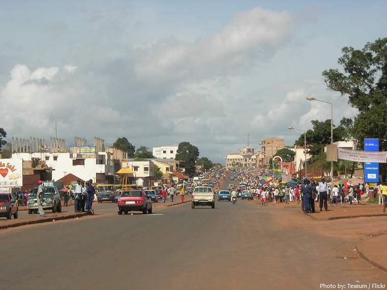
Bissau is the capital and and largest city of Guinea-Bissau. Built on a low-lying estuary where the Gêba River flows into the Atlantic, apart from the hectic traffic, Bissau is a low-key, unassuming capital. The city was founded in 1687 by Portugal as a fortified port and trading center.
The terrain of Guinea-Bissau is mostly low coastal plain with swamps of Guinean mangroves rising to Guinean forest-savanna mosaic in the east.
The highest point on Guinea-Bissau is 300 meters (984 feet) above sea level at an unnamed location in the northeast corner of the country.
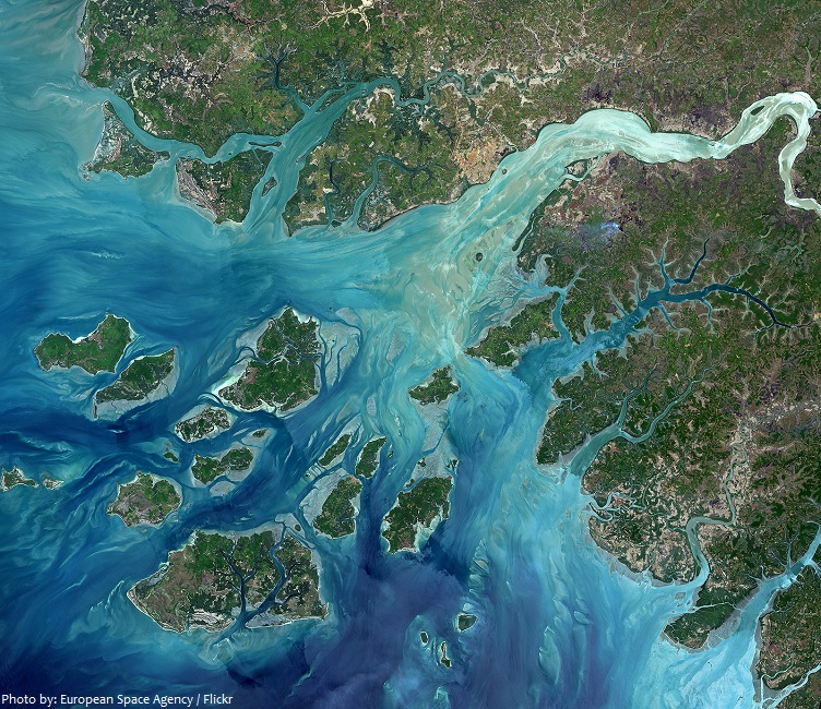
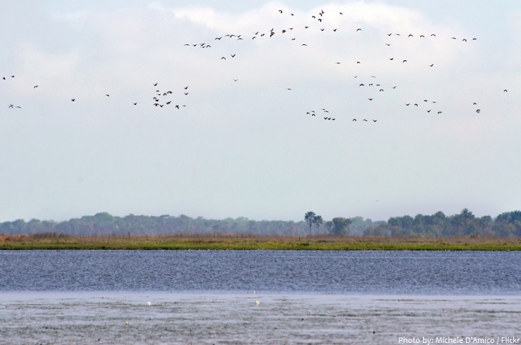
Guinea-Bissau has 350 kilometers (217 miles) of coastline. It is dominated by a few scattered beaches and swamps of mangroves.
Off the coast of Guinea-Bissau is the Bijagos Archipelago, a group of about 88 islands and islets located in the Atlantic Ocean. Only some 20 islands are populated year-round. The archipelago was declared in 1996 a UNESCO Biosphere Reserve—Boloma Bijagós Biosphere Reserve, known for animals including marine turtles, hippopotamus and the southern islands are today a nature reserve.
The network of protected areas in Guinea-Bissau covers about 16% of the national territory (5,780 square kilometers / 2,230 square miles). It is made up of 6 national parks, plus nature reserves, hunting reserves and other types of protected areas.
The most famous tourist attraction and national park in Guinea-Bissau is the Orango Islands National Park. It is part of the Biosphere Reserve of the Bijagós Archipelago. Like all the other national parks in the country, it was founded back in 2000. The park is not just a terrestrial park. It is also a marine park. The former has a total of 1,582 square kilometers (611 square miles) while the latter is humongous at 94,235 square kilometers (36,384 square miles). The continental shelf of Bijagos Islands is part of the national park.
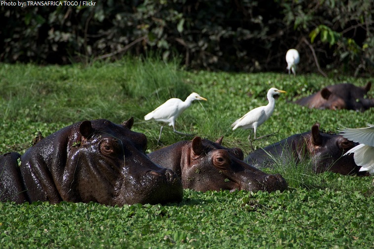
The Lagoas de Cufada Natural Park was established on 1 December 2000. This site is 890 square kilometers (345 square miles). It is a Ramsar Wetland site meaning it has an ecosystem worth protecting and as such, animals like chimpanzees, hippopotamus, waterbuck, Roan antelope, African buffalo, leopard, hyena and Arfrican dwarf crocodile all co-exist in the area. The park has an IUCN category II national park status.
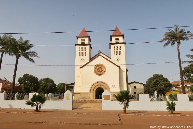
Bissau Cathedral, also known as Sé Catedral de Nossa Senhora da Candelária (Cathedral of Our Lady of Candelaria) is a Christian cathedral in Bissau, Guinea-Bissau. It is the centre of Roman Catholicism in Guinea-Bissau. The cathedral is under the Diocese of Guinea-Bissau, which was created in 1977. Situated in the downtown area of Bissau, it is noted for its function as a lighthouse. Services are held in Portuguese language.
The precolonial history of Guinea-Bissau has not been fully documented in the archaeological record. The area has been occupied for at least a millennium, first by hunters and gatherers and later by decentralized animist agriculturalists who used iron implements for their rice farming.
Guinea-Bissau was once part of the kingdom of Gabu, as well as part of the Mali Empire. Parts of this kingdom persisted until the 18th century, while a few others were under some rule by the Portuguese Empire since the 16th century.
Portuguese Guinea was known as the Slave Coast, as it was a major area for the exportation of African slaves by Europeans to the western hemisphere.
Upon independence, declared in 1973 and recognised in 1974, the name of its capital, Bissau, was added to the country’s name to prevent confusion with Guinea (formerly French Guinea).
Once hailed as a potential model for African development, the country is now one of the poorest
countries in the world.
The vital cashew nut crop provides a modest living for most of Guinea-Bissau’s farmers and is the main source of foreign exchange.
Guinea-Bissau also exports non-fillet frozen fish and seafood, peanuts, palm kernels, and timber.
Rice is a staple in the diet of residents near the coast and millet a staple in the interior. Fruits and vegetables are commonly eaten along with cereal grains.
There are about 40% Muslims, 22% Christians, 15% Animists and 18% unspecified or other.
Football is the most popular sport in Guinea-Bissau.
The Guinea-Bissau Carnival is a cultural extravaganza that explodes onto the streets of the capital Bissau during February when the weather is also at its most pleasant. The carnival takes place over the four days before Lent, is like no other.