Burkina Faso is a landlocked country located in West Africa.
It is bordered by six countries Mali to the north, Niger to the east, Benin to the southeast, Togo and Ghana to the south, and Ivory Coast to the southwest.
The official language is French.
As of 1 January 2017, the population of Burkina Faso was estimated to be 18,909,665 people.
It is the 74th largest country in the world in terms of land area with 274,200 square kilometers (105,870 square miles).
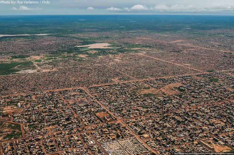
Ouagadougou is the capital and largest city of Burkina Faso. It is the administrative, communications, cultural and economic centre of the nation. The city’s name is often shortened to Ouaga. The inhabitants are called ouagalais.
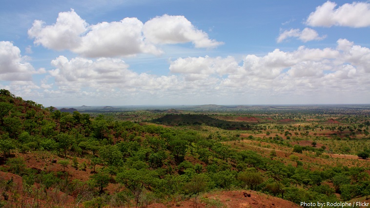
Burkina Faso terrain is mostly flat to dissected, undulating plains and hills in west and southeast.
Mount Tenakourou is the highest point of Burkina Faso, with an altitude of 747 meters (2,451 feet).
The average altitude of Burkina Faso is 400 meters (1,312 feet) and the difference between the highest and lowest terrain is no greater than 600 meters (1,969 feet).
The land is green in the south, with forests and fruit trees; and desert in the north.
The country has a number of lakes and river basins. The largest is the Volta basin with its three rivers – the Black Volta (Mouhoun), Red Volta (Nazinon) and White Volta (Nakanbe) running through the central and western half of Burkina.
Burkina Faso has 4 national parks, 1 UNESCO Biosphere reserve, 3 Complete Reserves, 6 Partial Reserves and 10 protected forests.
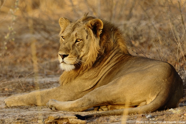
Arli National Park often called Arly is a national park located in southeastern Burkina Faso. It adjoins Benin’s Pendjari National Park in the South and the Singou Reserve in the West. The park is home to around 200 elephants, 200 hippos and 100 lions. There are also buffalo, baboons, red and green monkeys, warthog, boar and various antelope such as western hartebeest and roan antelope. There are also bushbucks, duikers and waterbuck.
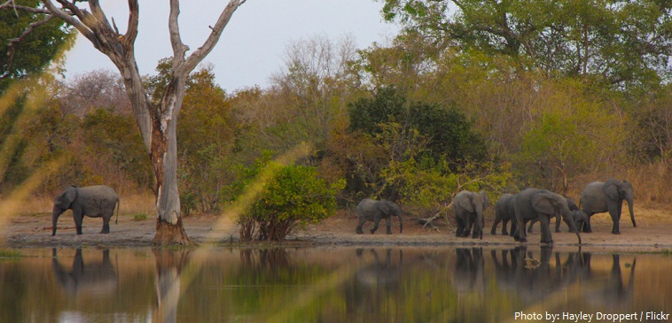
Nazinga Reserve protects the largest elephant population in West Africa. It is the best place to get up close and personal with the gentle giants and many other wildlife species. It is one of the most beautiful natural areas in the country, and is not far from the capital of Ouagadougou.
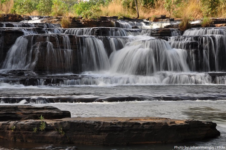
The Cascades de Karfiguéla or the Banfora Cascades are a series of waterfalls along the Komoé River in Southwestern Burkina Faso. It is one of the most important tourism sites in Burkina Faso.
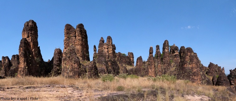
The peaks of Sindou are a rock formation near the town of Sindou. The peaks are one of Burkina’s most unforgettable sights. Millions of years ago, these brown, sandy cones were underwater, and they’ve been shaped by the elements ever since.
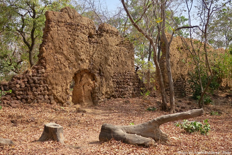
The ruins of Loropéni are an ancient heritage site near the town of Loropéni in southern Burkina Faso. They were added to the UNESCO World Heritage List in 2009. These ruins are the country’s first World Heritage site. The site, which spans 11,130 square metres (119,800 square feet), includes an array of stone walls that comprised an ancient fortress, the best preserved of ten in the area.
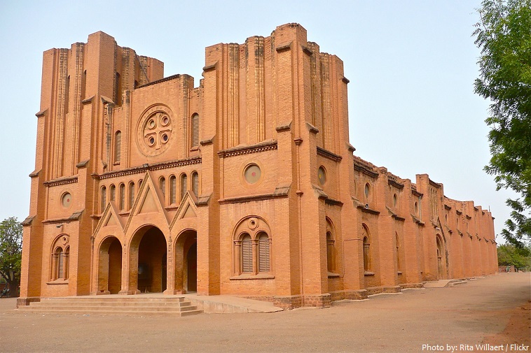
Ouagadougou Cathedral is the cathedral of the Roman Catholic Archdiocese of Ouagadougou in Ouagadougou. It was built in the 1930s, by apostolic vicar Joanny Thévenoud from the White Fathers, at the time of French North Africa, and was dedicated on 19 January 1936, after a two-year construction.
The northwestern part of today’s Burkina Faso was populated by hunter-gatherers between 14,000 and 5,000 BC.
From the 3rd to the 13th centuries AD, the Iron-Age Bura culture was situated in the territory of present-day southeastern Burkina Faso and southwestern Niger.
Various ethnic groups of present-day Burkina Faso, such as the Mossi, Fula and Dyula, arrived in successive waves between the 8th and 15th centuries.
Oral traditions then speak of warrior tribes and horsemen invading the area from the 15th century and establishing kingdoms – the Gurmanché in the east, the Fulbe and Tuareg in the north and the Mossi in the centre.
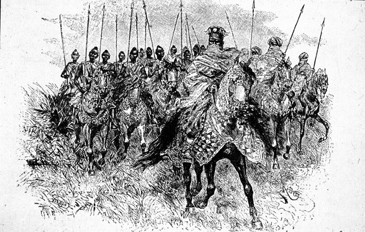
Several Mossi kingdoms developed, ruled by kings or nabas. The most powerful had its centre at Ouagadougou and was headed by the Moro Naba (‘great lord’).
Having defeated the Moro Naba in 1896, the French took control of the region. They divided it into administrative cercles (“circles”) and allowed the various chiefs to keep their traditional seats.
The French joined the region to other African countries in the first half of the 20th century. Burkina Faso as it stands today was only established in 1947, when it was named “Upper Volta” by the French. Independence came in 1960.
The Republic of Upper Volta was renamed “Burkina Faso” on 4 August 1984 by then-President Thomas Sankara. The words “Burkina” and “Faso” both stem from different languages spoken in the country: “Burkina” comes from Mossi and means “honest” or “honest people”, while “Faso” comes from the Dyula language and means “fatherland” (lit. “father’s house”).
As one of the poorest countries in the world, Burkina Faso has around 44% of its population living under the poverty line.
Burkina Faso is Africa’s largest producer of cotton. Local farmers call it their ‘white gold’. Cotton is the mainstay of the country’s economy, earning over 200 million dollars in revenue each year.
The country has 147 mammal species, 330 aquatic species including 121 species of fish and 2067 different plant species.
Fauna, one of the most diverse in West Africa, includes the elephant, hippopotamus, buffalo, monkey, lions, crocodile, giraffe, various types of antelope, and a vast variety of bird and insect life.
Traditional beliefs hold that crocodiles and humans share the same spirit. Therefore to a Burkinabe, the animal is sacred.